The Northville Lake Placid Trail (NLPT) is not a route for peak baggers. Unlike many other long distance hiking routes, the NLPT does not follow the spine of a mountain range. Instead, the NLPT crosses the adirondack dome via natural corridors provided by the many rivers and streams that define the landscape. Nearly the entire route stays below 2500 feet, with one prominent exception. The section south of Route 28N (east of Long Lake) crosses a steep ridge line at just over 3000 feet.
Walking south on the NLPT from the parking area on 28N, it's 3.5 miles to the ridgeline with 1300 feet of climbing. You ascend gradually for the first three miles and a good chunk of the elevation is gained in the last half mile. The trail then follows the ridgeline for half a mile before dropping off steeply to begin the descent towards Tirrell Pond and points south. I've hiked in this area many times but it's been years since I walked along the ridgeline in mid-summer. What a shame. The half-mile along the crest of the ridge is an uncommon delight.
Spruce, Fir and other common sub-alpine species mix-in, but the canopy along the ridgeline is dominated by Yellow Birch.
Three thousand feet is not high, even by modest Adirondack standards, but the forest community present on this ridge is uncommonly attractive. Above 2800 feet, on the northern side, the forest canopy is dominated by mature Yellow Birch with an understory consisting primarily of fern-filled meadows. This is not a named ecological assemblage (NYS Natural Heritage Project) and this elevation is considered to be the upper limit for Yellow Birch.
I spent two hours exploring the ridge line and simply sitting, relaxing, and enjoying the solitude.
Ecological communities are highly variable. There are the defining characteristics of a locale: climate, soil, moisture levels, elevation, slope, and so on, but these characteristics simply provide a baseline. The forests we see today have been shaped by disturbances: disease, fires, storms, droughts and logging. I suspect that the forest present on the ridgeline southeast of Long Lake emerged from an event that took place on November 25, 1950. If you know anything of recent Adirondack history that date should ring a bell. That's the date of the great Adirondack hurricane. What locals refer to simply as the 'blowdown'.
We tend to think of hurricanes as tropical storms but the storm that blew through the Adirondacks on that November day exhibited the same characteristics; heavy rain and intense cyclonic winds formed around a compact low pressure area. With recorded wind speeds of up to 100 miles per hour, this storm would been memorable under any circumstances, but the effects were greatly magnified by the wind direction. Any large tree growing in the Adirondacks has stood fast against many storms and, over time, the trees brace themselves against the prevailing northwesterly winds. The 1950 storm battered the forests from the south and, worst of all, the northeast. Those northeasterly winds hit trees growing on north facing slopes particularly hard and in some places 50 to 75% of the mature trees came down.
Yellow Birch dominate the canopy and ferns fill the understory.
White Pine and Spruce tended to be most vulnerable and on the other end of the spectrum Yellow Birch tends to hold up well against high winds. If you're unfamiliar with Yellow Birch you might be wondering how birch trees could be so tough. The White and Grey Birch so common in suburban yards are the first trees to come down in a storm. Well, we can't pick our relatives, and Yellow Birch is an entirely different sort of tree. Yellow Birch is long-lived and specimens of Yellow Birch are among the oldest and largest trees present in Adirondack forests today. The ridge line southeast of Long Lake was hard hit by the 1950 storm and the mature Yellow Birch present there today prospered in the aftermath of that storm.
The Adirondack forest is damp and mossy. A few degrees warmer, and with a few more inches of rain annually, and the Adirondacks would be a temperate rain forest. Maybe that's what it will become in the future.
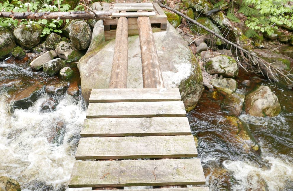
If the ridge line is out of reach the first mile of this trail passes through a large Spruce bog of uncommon diversity and beauty. I've walked the boardwalks of this section dozens of times but I enjoy it every single time. The picture is of water flowing in Shaw Brook. Roughly a half mile from the trail head.
Ghost plant (Indian Pipe) is a heteromycotroph. These plants lack chlorophyll and derive energy from fungus in the soil.
Dishrag Pond appears on modern maps as a tiny blue dot deep in the heart of the Blue Ridge Wilderness. The pond made its' first appearance on USGS topographic maps in the 1950s and that curious name has been on the list of Adirondack ponds ever since. The Blue Ridge Wilderness Master Plan (1) contains a single paragraph which describes the pond as extremely remote, devoid of fish, and exceptionally shallow. Historical images from Google Earth show a small body of water at the location but images from August 2015 show a mud flat surrounded by a swampy perimeter. A perfect destination for a hike.
Screen capture from Google Earth showing the pond as it appeared in August 2015. The Blue Ridge Wilderness Master Plan notes that the pond is exceptionally shallow with an average depth of one foot. From that it's reasonable to guess that the 'pond' goes missing when conditions are dry.
My plan was to walk the Northville Lake Placid Trail (NLPT) north from Wakely Pond (2) to intersect with a unmarked path that runs up the valley toward Dishrag pond (3). That path follows the route of a long abandoned woods road that ran from the Cedar River Road to the headwaters of Brown's Brook. It's just under five miles on the NLPT to the intersection and an additional 2.5 miles up the drainage to the vicinity of Dishrag Pond. All was going according to plan until I reached the crossing of Brown's Brook where the bridge is partially out.
The NLPT bridge crossing Brown's Brook is missing half its' planking. It's not evident how it got into this state since it's a relatively new bridge; this section of trail was opened in just the last ten years. When the water is low you can rock hop to cross the brook and, if the logs are dry, you might chose to walk across the beams. On this day the logs were damp and slippery and I was not prepared to wade. So I headed up stream to find a place where I could get across with dry feet. On the way back I crossed the broken section of the bridge on my hands and knees using my hiking pole as a brace. It was not graceful but at that point I was not looking for style points.
Normally you might bypass the bridge and rock hop to cross the stream but two days of heavy rain had the brook running hard. I also considered walking the exposed logs but they were damp and slippery. Since I would be going up the valley anyway I figured the best bet would be to bushwhack along the stream until I found a place where I could cross. The first complication with that plan was that the banks of the brook are quite steep just above the bridge. So headed back up the trail to find a better spot to rejoin the brook. Eventually I did scramble down to the brook to take a look but the near bank was still quite steep and it was bordered by thick brush. Not ideal. More bushwhacking upstream expended a lot of energy but eventually I was able to get across with dry feet. My advice? Be prepared to wade this stream unless you know that the water is low.
A dense spruce thicket lines the north bank of Brown's Brook for a considerable distance above the NLPT bridge. It's a good 100 yards through this thicket before you emerge in the more open forest that lies beyond.
Getting to the far side of the brook revealed the next challenge. A spruce thicket lines the north bank of Brown's Brook and it took several minutes to find a way through and reach the open hardwood forest beyond. The spruce thicket along Brown's Brook is extensive and large spruce are present in the forest all the way to Dishrag Pond. This is notable because spruce were highly prized by loggers working this country in the early days of Adirondack logging. The abandoned road I would eventually find is seen on the first USGS map of the area published in 1903 and that probably means the area was logged before that date. The large spruce present today might have been too small to bother with back then and the passage of over 100 years has allowed them to reach mature sizes today.
The route to Dishrag Pond from the NLPT
Coming out of the band of dense growth along the brook I was unsure how far it was to the old road. Since I would be going up the valley either way I hedged my bets and set out towards a large unnamed vly that sits half way between the NLPT and Dishrag Pond. Following this course I would eventually reach the vly or find the path. After forty five minutes of bushwhacking pushed through a wall of brush I stepped out onto a clearly defined woods road. I'd hit the path at the point where the road forded the brook that flows out of the vly. The path, the brook and the vly came into view at the same time as did clarity as to where I was. A few minutes earlier I had thought that I'd have to give up on Dishrag Pond because of a lack of time, but this changed everything. The way was now clear. I could follow the old road to see where it goes.
The old road just above where it fords the brook flowing from the unnamed vly. Until I stepped out on to it I was not sure how distinct the way would be. This would be hard to miss.
Looking down the vly from the western end. This point is easily reached from the abandoned road that passes south of the vly.
From the vly to the vicinity of Dishrag pond the road is easy to follow but not easy going. Blowdown blocks the way in numerous places and the surface was consistently wet and muddy. Even so, I made decent time and just as I was starting to think that I must be getting close I rounded a bend to see the rusted hulk of a long abandoned car. The Ford coupe (I think from around 1940) had probably broken down at that spot and it has remained there ever since.
This abandoned car at the end of the old woods road provides known location for orienting yourself for the final push through the forest to Dishrag Pond. It appears to be a 1940 Ford Coupe and it probably broke down at this spot and was abandoned.
Just past the car the road ends. The 1903 USGS map shows the road reaching a small water body. If that was correct then the final stretch of road has been completely reclaimed by the forest. I couldn't tell exactly where the pond lay in relation to where I was, but, having come so far, I took my best guess and headed off through the forest one more time. What I learned is that the quarter mile between the end of the road and the string of beaver meadows below Dishrag pond is wet, very rough, and extremely thick. I hoping for at least a glimpse of Dishrag Pond but it was not to be. The pond couldn't have been more than a few hundred yards away, but it was 2:00 pm and getting there was going to take a while. So I turned for home. I'm unusually pretty good at retracing my steps through the woods and I tried to return to the spot where I had left the road. But even that proved to be difficult. As I said, the terrain is rough and the cover is exceptionally thick.
Looking across one of the beaver swamp/meadows just downstream from Dishrag Pond. The Blue Ridge is seen in the background.
If you want to reach Dishrag Pond leave the road 300 yards back from the place where you find the old car. Head north north west and stay in the hardwoods for as long as you can. I may have to return some day to see what Dishrag Pond actually looks like.
(1) Blue Ridge Wilderness Master Plan
(2) There is limited parking for the NLPT north at a pull-out on the Cedar River Road at Wakely Pond, The NLPT leaves the road at that point and enters the woods on a gravel road that can be driven a short distance to a pull out where additional cars can be parked.
(3) Current maps so the route as an unmarked path that ends at the vly halfway to Dishrag Pond. In fact it's an old woods road easily followed to a point a quarter mile from the pond.
In my previous post I wrote that I don't often return to trails I've walked before because there are so many new and interesting places left to see. Particularly because I like to pick out old trails to see if I can find and follow them. Routes that the New York State Department of Environmental Conservation (DEC) lists as "unmaintained" are my favorites. So the trail to Carry Pond and then up the valley of Little Squaw Brook would be just perfect. Plan A was to ford the Cedar River (near the Carry Lean-to), visit Carry Pond, and then follow the trail up the valley for a couple of miles. For reasons I'll get to in a minute, plan A did not happen.
South along the Northville Lake Placid Trail from Cedar River Flow. The yellow lines are trails from the DEC trail reference (KML file you can download). The blue line is my route covering about 12 miles out and back.
Cedar River Flow. A warm, cloudy and very still mid-October day. So warm in fact that a few misquitos joined in the fun.
Heading south on the Northville Lake Placid Trail from the Moose River Recreation Area main road (Trailhead and small parking pullout located a mile south of the Cedar River Flow entrance) the route passes along the south west side of Cedar River Flow and then through an area logged in the not too distant past. The trail follows what was originally a well-built logging road and the forest is primarily second growth with several bogs and swamps thrown in to keep things interesting.
Looking west across one of several bogs crossed by the Northville Lake Placid trail south of Cedar River Flow; Manbury Mountain in the distance.
A sphagnum moss bog passed between Cedar River Flow and the Carry Lean-to. This was taken on my return trip when a brief glimmer of sun gave hope that the heavy cloud cover might break. Five minutes later it was raining.
A little over three miles from the trailhead an abandoned woods road enters from the west and you pass iron posts that would have supported a gate. A bit further on I noticed an indistinct and unmarked trail leaving the NLPT towards the east and a minute later I reached the spur trail leading to the Carry Lean-to. Which meant that the indistinct trail just passed was the trail to the ford that would start the route to Carry Pond and Little Squaw Brook. Going back, I followed what is best described as a trace of a hint of a path down to the Cedar River. As places where you might try to ford a river go this was as unappealing a crossing as I have come to in the Adirondacks. The river at that point is slow moving and muddy providing no glimpse of the bottom so you could gauge the depth and footing. Worst of all the banks on both sides are steep and lined with thick brush. Crossing there? Not gonna happen.
Cedar River at the place where the abandoned trail to Carry Pond and the Little Squaw Brook valley crosses.
Trail signs at the junction where the short spur trail leads to the Carry Lean-to (which, based on signs on the trail has been renamed the Cedar River Lean-to).
Returning to the main trail I retraced my steps to the junction and followed the short spur to the lean-to to see if it might be possible to cross there. Though there is a landing on the near side of the river below the lean-to the basic conditions of the crossing reamined the same. Also not gonna happen. So, on to plan B. Which was to follow the main trail south to the Colvin Brook trail and follow it to the Colvin Brook lean-to.
The Colvin Brook trail is an eight mile spur that connects the NLPT with Route 30 at the Lewey Lake Campground. The route crosses a 3000 foot height of land between Lewey and Cellar Moutains. On the east side (coming from Lewey Lake) the trail is called the Sucker Brook Trail and it is an interesting and easy to follow route through stands of never logged or selectively logged hardwoods (I hiked it in 2013). On the west side, however, trail guides going back to the 90s have warned that the three mile stretch between the Cedar River and the height of land is obscure and difficult to follow. In keeping with this the DEC recently closed the trail citing extensive blowdown and beaver flooding. This is the trail that David Boomhower took in 1990 attempting to bail out on his NLPT through hike. A huge search effort failed to find him and his body was eventually discoverd a few months later by a hunter. He had made it over the height of land and was just a quarter mile from the trail. He had apparently lost his way and succumed to physical and mental exhaustion.
You'd need crampons to cross this partially collapsed bridge. It was steeply pitched and very slippery. Luckily, the water was low making it easy to bypass the bridge and rock hop across the stream.
Junction of the side trail to the Colvin Brook Lean-to and the NLPT.
From behind the Colvin Brook lean-to. This is a really attractive spot and this lean-to looks like it gets very little use.
But the mile long section of trail between the NLPT and the Colvin Brook lean-to is well marked and as attractive a forest walk as any in the Adirondacks. The route passes through maturing second growth stands of both hardwoods and softwoods including stands where large spruce and fir are present. The lean-to is on the east side of the Cedar River --so you have to cross to get to it-- but it's easy to rock hop across at times of low water.
The river provides a really attractive setting for a lean-to which appears to be infrequently used. The Colvin Brook trail proceeds past the lean-to where it immediately enters a stand of what I took to be old growth spruce and fir. That stand contains Red Spruce with diameters over 30 inches; uncommon in a region where spruce were relentlessly pursued by loggers. I followed the trail past the lean-to for quarter mile and it is intriguing, but I had six miles to cover to return to my car and the steady drizzle was threatening to become a full-on rain. So I headed back.
Old growth spruce near the Colvin Brook lean-to.
The Colvin Brook lean-to
Cedar River looking north from the crossing at the Colvin Brook lean-to
Back at Cedar River Flow on the return trip. Lewey Mountain in the distance.
This was my second ramble to the vacinity of the top of Blueberry Mountain. This particular Blueberry Mountain is located just south of Kemshall Mountain; a mile from the east shore of Long Lake. I had previously bushwhacked up the mountain from a point on the Northville Lake Placid Trail about 3.5 miles north of the NLPT parking area on Tarbell Hill road. The route I took on that first trip was very steep and it passed through a dense swath of Spruce and Balsam. At the time I decided my route was ill chosen and in fact I came down the north side of the of the mountain where I stumbled on the old trail up Kempshall Mountain. Since then I've been back and followed the abandoned trail to the top of Kemshall. That route climbs to a saddle between Kempshall and Blueberry and I figured that the best route up Blueberry would be to follow the old trail to the saddle and then bushwhack to the top from there. This is indeed the easier way to go.
A low cloud cover limited views from near the summit of Blueberry Mountain.
But the main reason to hike Blueberry again was that my brother Mike was visiting from Colorado and we were looking for a good outing. Something close to town, of moderate length and hopefully with views. Blueberry normally has fantastic views and I figured it to be a 12 mile round trip with the last 1/2 mile a bushwhack up from the saddle. That seemed like the right mix so off we went.
And we did reach the top basically as planned. The bushwhacking stretch was a little harder than anticipated but 45 minutes after we left the old Kempshall trail in the saddle we came to a boulder with a small cairn on top of it. There didn't appear to be any more "up" anywhere around so we declared that point to be the summit. As for the view, the top of Blueberry is in the elevation zone where dense stands of Spruce and Balsam typically dominate. And the cover on summit of Blueberry varies between dense and very dense. However, I knew from my prior visit that open rock slabs exist on Blueberry with great views. Searching around on top we did find some rock outcropings that could have had good views. Unfortunately, as the day had progressed the thick overcast had lowered until visibilty from the top was on the order of a quarter mile. Basically we were staring off into the clouds.
Yup, still limited over on the other side of the summit area.
There it is, the view, looking southwest from one of the open areas near the summit of Blueberry Mountain. This shot is from my prior visit in July of 2014.
Still, I assured Mike that there were two large areas of open rock where good views would normally be found and that maybe we could sneak a view through the clouds from one of those areas. After half an hour of searching, beating through the thickets, I sensed that Mike was starting to doubt that these "open areas" even existed (Ok, it didn't require any great powers of perception, he readily pointed out that this was his theory). Eventually we paused for lunch at a place near where we had first reached the top.
Screen capture from Google Earth showing our route. The orange line is the GPS track. The yellow line is the trail overlay from the New York State Dept. of Environmental Conservation trails map. This version (of the overlay) still shows the trail up Kempshall Mountain. That trail is officially abandoned and while still easy to follow it is not a marked trail.
A broader perspective on our route and the summit of Blueberry mountain. Kempshall is in the background.
Returning home the GPS track told the tale. We had circled around the summit of the mountain and the two large open areas (yes, they do exist) are slightly lower down; one on the west side and one on the east. We had come close to each one but had not gone far enough down the slopes to break out into the open. Oh well, there wouldn't have been views anyway. That is the story I'm sticking with. Now I'll just have to make the pleasent walk down the lake and up Blueberry again to see those great views. It could be worse.
Along the shore of Long Lake near the point where the abandoned Kempshall Moutain trail intersects with the NLPT. The lake is very low, even for this time of year (Oct. 1). The summer has been unusually dry and hot
Long Lake from near place where the picture above was taken. The bushes in this photo are also in the previous picture. In that one seen from the side. A point was under water when this picture was taken in July of 2014.
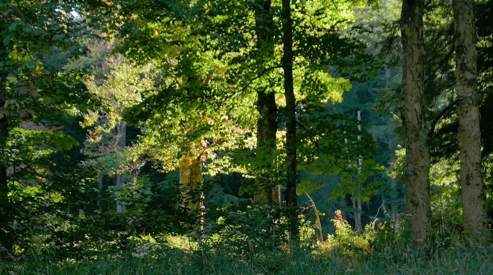
Forest scene from along the NLPT along the way to Blueberry Mountain.
Another forest scene. From July 2014.
Near the top of Blueberry Mountain. Previous visitors had built chairs from which to watch the sunset (one might imagine).
The six mile stretch of the Northville Lake Placid Trail from the Whitehouse parking area north to Piseco doesn't get a lot of use. The first 3/4 mile stretch sees day hikers headed for the side path to Big Eddy on the Sacandaga West Branch but beyond that there's nothing special about this section of trail. Hamilton Lake Stream (2 miles) is attractive, as is Priests Vly (3.2 miles), but most hikers using this route are backpackers.
Late afternoon sun along the Sacandaga West Branch. A glorious early fall day in the southern Adirondacks.
Near the far end, a mile short of where the NLPT crosses Rte.8 at Piseco, the trail crosses the outlet stream from Buckhorn Lake. The lake --shallow and swampy-- lies just a quarter mile off the main trail and while the lake is uninspiring the stream and surrounding woods are very attractive. This area has several nice camping spots and it seems likely that local people use the spot for day hikes and camping.
My hike from Whitehouse to Piseco and back, with side trips to Buckhorn Lake and Big Eddy, covered just under 15 miles. Most of this walk was in complete solitude through a rapidly maturing second growth forest. Keeping the hiker's creed in mind --start slow, taper off-- it took me nearly 9 hours to cover the distance. I walk slowly studying the forest and the mix of trees that make up the canopy. The hardwood forests of the southern Adirondacks are dominated by a few species: Maple, Yellow Birch, Ash and Hemlock. Where these trees have reached full height but with diameters commonly less than 30 inches (4 feet above the ground), I take it to mean that the area was probably logged early in the Adirondack industrial logging period. That period ran from roughly 1860 until the early twentyeth century and the southern forests were scoured for valuable timber first. If these assumptions are correct then canopy trees present today have been growing for 120 to 150 years. I have no formal training in forestry but that age estimate fits with trees that have attained full height but that are not yet middle aged. Much like people, middle aged and elder trees have greater diameters and they eventually take on a grizzled and worn look.
And the forests seen along this trail do contain some elder trees, so even if my logging assessment is generally correct the logging was probably done selectively. The largest and oldest trees, some with diameters over 40 inches, are mostly Maples with some Yellow Birch and Hemlock mixed in. This is typical of areas in the southern Adirondacks where White Pine, Spruce and Hemlock were sought out and taken but where hardwoods were sometimes ignored. In those days softwoods were prized but hardwood timber was available in more accessible locations.
The more adventerous part of my day came near the end. With less than a mile remaining on the return leg I left the main trail and followed the well-worn path towards Big Eddy on the Sacandaga. Then, as I approached the river, I foolishly came up with the idea that it would be nice to see something off the beaten path. So I left the trail seeking to bushwhack to the place where Hamilton Lake Stream joins the river just downstream from the "eddy". The water in both streams is exceptionally low this year --following a hot, dry summer-- and the undergrowth near the confluence is deep and thick. And swampy, really really swampy. I realized pretty quickly that my route was poorly choosen but I didn't want to turn back without at least seeing the river so I plowed on through. After 30 minutes of muddy, itchy, bushwhacking I had indeed seen the river and I was back at the place where I had left the trail. And that was a good thing. It was 5:30, I still had a mile and half back to the car, and I was moving rather slowly. Start slow, taper off.
Forest scene along the NLPT north of Whitehouse.
Another forest scene along the NLPT north of Whitehouse.
Hamilton Lake Stream from the bridge. Low water in late September of a dry year.
Priest Vly
Buckhorn Lake
Sacandaga West Branch just above the point where Hamilton Lake Steam enters.
I had forgotten about the circus that emerges spontaneously in the High Peaks on a holiday weekend. I've done plenty of hiking in the high peaks but in recent years I've avoided the region almost entirely. Somehow it never occurred to me that my plan, a long walk to the Cold River along the northern edge of the Seward Range would pass straight through the melee.
The High Peaks Wilderness region is rugged and strikingly beautiful but not particularly wild. However, this intersection, near the place where I turned around, is about as far away from civilization as you can get in the Adirondacks.Several trail systems come together in this vacinity but no trailhead is less than nine miles away.
It used to be the that the "Sewards" were remote and untrailed. And these four remote mountains represented one of the stiffer tests to be overcome by a potential '46er'. But these days the access trails are much improved and what were once herd paths up the mountains are now well worn trails. Even so, I was caught off guard at finding 50 or so cars already present in the parking area at 8:00 am on a Saturday morning. I really should have known; labor day weekend with a darn near perfect weather forcast; cloudless sky, 70 degrees, low humity - Jackpot! Seeing all the cars I considered heading for a different trailhead but if I did no one would know where I had gone so I stuck with the plan and headed out. And despite the overflowing parking lot I didn't encounter a single person on the first leg of the trip; the 4.5 mile walk to the Blueberry lean-to. The scene at the lean-to, however, brought a chuckle. I counted 11 tents in the vacinity of the lean-to and a half dozen packs inside. But it was quiet and there was no one around. The tents and gear belonged to what I imagined must have been a parade of hikers setting off a couple of hours earlier to bag the peaks.
Beyond the Blueberry lean-to this route passes --in succession-- the intersection with the Ward Brook Truck Trail, the Ward Brook Lean-to, and the two "Number Four" lean-tos. The Number Four location is 6.5 miles from the parking lot and it also features a horse coral though I saw no evidence that any horses had recently come along to enjoy the spot. The "number four" that gives this place its' name is seen on old topograpic maps. The spot is marked simply as "Camp" on the 1923 edition of the 1:62500 scale USGS map but that was changed to Camp No. 4 on the 1930 edition. To distinguish it from other camps shown on the maps one might suppose.
The 1930 edition of the 1:62500 USGS topographic map of the area. Camp No. 4 is a little right of and below the center of the image. This image was taken from a map available from the USGS Topoview map repository.
Also seen on the map is something called the "Government Trail". That "trail" at some point became the Ward Brook Truck Trail connecting roads in the Ampersand Lake area with Duck Hole and probably the mines and iron works at Tawhaus further to the southeast. The trail from the Number Four lean-tos to the Cold River follows this truck trail and the abandoned gravel roadway provides an excellent base for walking. These "truck trails", found throughout the Adirondacks, were mostly built in the 1930s as Civilian Conservation Corp projects or in the years immediately following World War Two. Most have deteriorated badly in the 50 years since maintenance ended but this one has held up very well. In particular, the bridges that span the many brooks and streams were well built and only a couple are starting to sag. The story of the truck trails can be found on-line and it represents an early battle over how the forest preserve was to be managed.
Intersection where the Sewards trail joins the Ward Brook Truck Trail.
The Ward Brook Truck Trail follows a well build gravel road all the way to Duck Hole. This photo was taken from the same location as the one above (looking in the opposite direction). From this point it's .7 miles to the Ward Brook Lean-to and an additional .7 miles to the two "Number Four" lean-tos. The trail is smooth and well traveled to that point. Past the last lean-to the forest is closing in and the trail narrows to a footpath.
Past the last lean-to the road narrows to a path and it takes on a distinctly wilder feel. But this was a well built road as evidenced by this bridge nearly eight miles distant from the trailhead. When this road was in use it reached all the way to Duck Hole and every brook and stream was spanned by a sturdy bridge.
The hike to the Cold River and back covered a bit over 19 miles. That's a long way to walk by any standard but the relatively smooth made it a bit easier than it sounds. Much of the day passed in the solitude that I enjoy on these long outings but at the very end of the day a lost dog brought me back to earth. Over the last few miles of my return trip I had passed two backpackers, a man first and then a ways further on a woman, both looking for their lost dog. The dog had run off and not returned and while the man looked worried the young woman --forlornly calling her dog's name into the woods-- was clearly stressed. They were asking every hiker to be on the lookout for the black dog with the yellow kerchief.
Continuing out to the road I found that the dog had returned to the trail head parking area where it was crouching next to the couple's car; peeking out to see if one of its' humans had returned. The dog also was stressed and, despite assurances from the woman that the dog was super friendly, any approach closer than a few feet brought a growl. Luckily a second hiker, who had also heard the story and, most importantly, was much younger than I am, volunteered to go back up the trail to fetch the woman. Not wanting to chance the dog doing something even crazier I sat on a log and waited; trying all the while to coax the dog over to me with some carrot sticks (that being the only edible item left in my pack after a ten hour hike). But the dog was having none of this. So we waited. After a while we heard voices and the dog went to full alert. When moments later the woman and the second hiker appeared in view there was a most joyous reunion. The dog sprinting to greet her and then coming back to me as if to say, "I wanted to be friends with you but I wasn't sure". With carrot sticks laying about on the ground I explained that I was trying to lure the dog over, to which the woman replied that the dog was "not vegetarian". This slightly ridiculous exchange flowed out of the overwhelming sense of relief and joy that everyone was feeling at that moment. We didn't know what to say. In thanking us the the woman made the point of saying that she if had a million dollars she would have handed it to us on the spot. Failing that she added that she would find a way to thank us by "paying it forward". Ah, joy.
What a wonderfully odd but happy way to end the day.
A water strider enjoying a stroll on one of the numerous streams that flow down out of the Sewards.
Now walking with a friend.
One of the numerous streams that are the primary appeal of this route.
The three mile stretch from the last lean-to to the NLPT trail junction is remote and wild.
Sturdy bridge over Moose Creek. Just above the confluence with Cold River.
Moose Creek looking towards the Cold River Confluence.
The flora of the Adirondack forest is a big part of what makes it feel like home for me.