Showing posts with label High Peaks Wilderness. Show all posts

Sunday, August 27, 2017

Solitude in the High Peaks - Pinnacle Peak

I generally avoid the Eastern High Peaks. Many areas lack the solitude and wildness that I find appealing. But you can't beat a great view and I've long been intrigued by a small peak south of Mt. Marcy named the Pinnacle. The Pinnacle sits at the western end of the range that includes Nippletop, Colvin and Blake. At just 3400 feet Pinnacle avoids the 46er curse, and there's no easy way to get there, so even on a gorgeous late summer day crowds seemed unlikely.

View from near the top of the Pinnacle. The Great Range (L. to R.): Mt. Marcy, Haystack, Basin, Saddleback, Gothics. Ausable Lakes in the foreground.
The route follows the Panther Gorge Trail from the Dix Mountain Trail head at Elk Lake. The Panther Gorge trail starts across the road from the parking area (the Dix Trail goes off separately) and provides a southern approach to the highest peaks. Using this trail it's ten miles to the summit of Marcy and this is probably the least used approach to the Great Range. After five miles on the Panther Gorge trail you reach the junction with the Pinnacle Trail and it's an additional 1.8 miles to the top from there. The Pinnacle trail is rough, but relatively level, until after a mile you reach a junction with a private trail coming up from the Adirondack Mountain Reserve. That's where the climb begins. From there you'll gain 1300 feet of elevation in the remaining eight tenths of a mile to the top.

This route does not get a lot of use. I walked it on a perfect late August day and met two people on the trail for the entire day. However, I did see plenty of other hikers. I got a late start and by the time I got to Elk Lake the Dix trail head parking was full (no parking is allowed along the road). This meant that I (and many many others) had to park two miles back along the road at Clear Pond. The extra two miles on both ends of the hike meant that my planned 14 mile hike was going to be an 18 miler. The two extra miles went by quickly in the morning but, at the end of the day, walking slowly back along the road with darkness falling, I was afraid to stop. Not afraid of the dark, but afraid that if I sat down I might not be able to get started again. I got back the car at 8:00 pm after 10 hours of continuous hiking. In addition to the distance, the trail crosses the Colvin Range ridge (in both directions) so total elevation grain for the day was 4300 feet. All in all, one of toughest hikes I've done in recent years.


The lay of the land (screen capture from Google Earth). 

One of the highlights of the day was catching glimpses of what I believe were several (two, possibly more) Bicknell's Thrushes near the summit of Pinnacle (3400 feet). This secretive bird breeds at high elevations in the northeastern U.S. and Canada and, with a very limited breeding range, it is rather rare. Bicknell's is not easily identified in the field but these birds were definitely thrushes and, given the location, Bicknell's Thrush is the likely ID.

Viewed on a map, or in Google Earth, the Pinnacle is a non-descript bump on a ridge surrounded by much bigger mountains. But, as for views, this is a giant. There are fantastic views of the Great Range and crossing the summit there are views of the Dix Range and Elk Lake. The pictures tell the story.

Elk Lake. Looking southeast from the Pinnacle.


The ADK Guidebook says that the trail climbs steeply at times. This nearly vertical ladder near the top qualifies as "climbing steeply".

Mount Marcy (left) and Haystack. The rocky knob of Little Haystack is seen on the far right.

Mt. Macomb. The other Dix range peaks are visible though the trees from the summit of Pinnacle.

Looking south towards Hoffman Mountain and the peaks of the Blue Ridge Range.

Another shot of Marcy and Haystack. With the Upper Ausable Lake just visible in the foreground.

The Pinnacle trail (1.8 miles from the Panther Gorge Trail to the top) passes though a magnificent hardwood forest. Ancient Yellow Birch with diameters approaching 4 feet are seen along with old growth Maple. The Spruce near the summit appear to be untouched by loggers or fire with numerous large trees present. 


No Adirondack hike is complete without encountering an odd fungus along the trail. Despite the distinctive color, and an unusual foul odor, I've not been able to identify this particular variety. 


Monday, November 16, 2015

Kempshall Moutain: Forgotten but not Lost

Kempshall Mountain, elevation 3380, lies just east of Long Lake in the southwest corner of the High Peaks Wilderness. The mountain's only real claim to fame is that a fire tower previously stood on the summit. The tower was closed in 1971 and removed from the mountain in 1977. By 1990 the trail to the top was officially abandoned. The old trail can be reached on foot by hiking north on the Northville Lake Placid Trail (NLPT) from the Tarbell Hill Road trailhead just east of Long Lake village. It's 4.5 miles From the parking area to the trail junction. Old guidebooks to the NLPT listed Kempshall as a two mile side trip with good views of the high peaks. But, without the tower, there are no views and recent editions have noted that the trip up Kempshall is "not recommended".

Wow, an abandoned trail listed as "not recommended". For me that's an irresistible combination. Views are not everything and these routes are often times fascinating for other reasons. That was certainly the case for the climb up Kempshall. Hopefully you can get a sense of it from the pictures.

Snow had fallen two nights before but as I hiked the temperature rose to above freezing. I was fascinated by the changing conditions as I climbed from the notch at 2300 to the top of the mountain at just under 3400 feet. At the lower elevations the snow plastered on every tree was transitioning directly to water and every gust of wind produced a shower of cold water. 
Most of the day was heavily overcast, but occasionally the sun burst through.


A few of the old State trail markers can still be seen along the trail. 

Setting off I didn't know what to expect. This trail is mostly forgotten but would it be hard to find or follow? The answer to that question is a definate no. The junction where the Kempshall Mountain trail leaves the NLPT is not marked, but it would be hard to miss. And the first mile of the route follows an old tote road to a notch between Kempshall and Blueberry mountains. On top of that, it soon became evident that the trail has recently been brushed out. Someone has cut back the small trees that quickly obscure abandoned paths in this neck of the woods. In a few cases larger blow down had been cut as well, up to the size that you might tackle with a hand saw.

After about a mile of moderate uphill hiking the path crosses a pretty little brook and steepens. At that point, at about 2300 feet, the trail enters a particularly dense spruce-fir thicket. The trail narrows and the trees close in. The route then alternates between moderately steep and very steep as it climbs 1000 feet in less than a mile. It was in this stretch that the recent work on the trail became highly evident and much appreciated. Blow down blocking the trail had been cut and, in places where rerouting was necessary, marker ribbons had been added to show the way.


The fire tower site is completely hemmed in by the forest. The tower foundations are evident, so I know that this was the spot, but there no openings for views. Even so, the trees, the snow and the light produced some appealing images. 

Despite the recent work it's safe to say that the Kempshall summit does not get a lot of visitors. The climb up from the notch, and the summit itself, have a distinctly wild and forgotten feel. Totaling 13 miles for the round trip, with a steep climb for the last mile, the hike demands endurance even in summer. Doing the hike in mid-November it was an adventure. I was prepared for early winter but I had not anticipated the large amounts of water coming off the trees. I was pretty wet when I got to the top and my slow pace on the steep and icy descent meant that it was dark when I got back to the car.

A perfect day.

Sunday, October 11, 2015

Santanoni Preserve - Newcomb Lake to Moose Pond

By the time I finished my hike to Moose Pond I had, according to my GPS, covered over 17 miles. That's a long walk, but it's not as difficult as it might sound because much of the way was over trails that follow what were once well-built woods roads. That makes for relatively fast and easy walking. It also didn't hurt that it was a nearly perfect day for hiking; early fall, cool, and mosquito free. I walked the Newcomb Lake road to the Moose Pond crossover trail. Then over the crossover trial to the Moose Pond Horse trail and out the Moose Pond trail to the pond. I returned following the Moose Pond trail back to the Newcomb Lake road and out.

The route as recorded by my GPS and viewed in Google Earth. That's Newcomb lake on the right and Moose Pond at the upper left.


The highlight of the route is the five mile trail that connects the Newcomb Lake road with the Moose Pond Horse Trail. The Newcomb Lake road is the five mile long gravel road leading to Camp Santanoni on Newcomb Lake. This area is managed by DEC as a historical site and the road (closed to public vehicle traffic) is a great walk in its' own right. The road also delineates a section of the High Peaks Wilderness boundary so, when you leave the road (after four miles) you immediately enter the High Peaks Wilderness. The five mile long trail that connects the road with the Moose Pond Horse trail is a beautiful and invigorating walk.

Fall in the Adirondacks. Even the swamps look good.

The first section of the connecting trail stays south of Newcomb Lake until you reach the unnamed inlet stream at the west end of the lake. This stream flows through an extensive wetland which is crossed without difficulty over a solid bridge and then a long split-log boardwalk.

Bridge over the inlet stream.

The boardwalk crossing the Newcomb Lake Inlet. 
Just past the end of the boardwalk you reach a trail junction. Turning right the trail leads along the north shore of the lake and loops back to the great camp area and the road. The trail to Moose Pond turns left (west) and enters a spruce/cedar forest.

For someone interested in forest communities, and succession in forest communities, this section of the trail is fascinating. The terrain is flat, and wet, and the forest mix is typical for that type of terrain; dominated by Spruce and Balsam Fir. The interesting part is that the Spruce here are larger than is commonly seen. Probably not virgin timber large, but old second-growth large. Added into the mix are large Cedars that appear to be quite old. On a clear fall morning this section of trail felt like a trip back through time.


Large cedars are mixed in with Spruce, Balsam Fir and other tree species.

And this trail is little used. From the bridge the trail stays close to the stream for a mile or so and this section of trail is overgrown with some blowdown to work over and around. There are a few places where if it weren't for the trail markers you might have to search around a bit to find the path.

Eventually the route gains enough elevation that you enter a mixed hardwood forest. This section of the route covers roughly two miles before joining up with the Moose Pond Horse Trail. It's not a particularly interesting section and much of the route follows what I took to be old logging roads. The larger trees are Sugar Maple and Yellow Birch so there may have been selective logging in this area. None of the trees are particularly large and my guess is that logging took place here 50-75 years ago.

A highlight of this section is the beaver pond/swamp/meadow that you reach about half way between Newcomb Lake and the Moose Pond trail. It's an attractive spot and from the beaver dam you get an interesting view of a sharp little pinnacle on a ridge of Moose Mountain.

Fall in the Adirondacks.

Past the beaver pond the trail trends to the northwest as it contours around a couple low ridges. About a half mile before the junction with the Moose Pond trail the route veers to the south, travels in that direction for a couple hundred yards, turns west, and then back to the north.. Much of the crossover trail is faint, but at this point the route-finding becomes a significant challenge.


I knew that the Moose Pond trail was a quarter mile away to the west and I could have simply headed in that direction until I hit it. That option was unattractive, however, because a swampy wetland lies between the two trails. That quarter mile would have undoubtedly been wet and muddy so finding the path was still the best bet.

Reaching a place where I could no longer pick up any hint of a path I suspected that the trail had been re-routed and that I missed a detour. So I doubled back to see if I had missed a turn. I back-tracked for over a quarter mile and, if there was a detour, I couldn't find it. In any case, continuing on where I thought the trail should be, I soon spotted a trail marker and an arrow sign nailed to a tree. From there it was just a couple hundred yards to the junction with the Moose Pond trail. If you go this way you should be comfortable finding your way through the woods.

There it is! Back on the trail.

It's hard to keep up the pace when hiking on a day such as this. Every turn of the trail brings another photo opportunity.

From the junction it's 1.3 miles to Moose Pond with a decent little hill in between. Given the the round trip from the junction to the lake would add 2.5 miles to an already long day, I thought about just turning towards home. But I'm glad that I didn't. The view across Moose Pond to Santanoni Mountain, and its' prominent slide, was a delight. And, the forest around the pond is older. Most of the old trees are hardwoods with some large Maple and Yellow Birch present. But, best of all, close to the edge of the pond I spotted a White Pine in that rare category of "trees with diameter over 48 inches". Trees of that size are rare in the Adirondacks today.

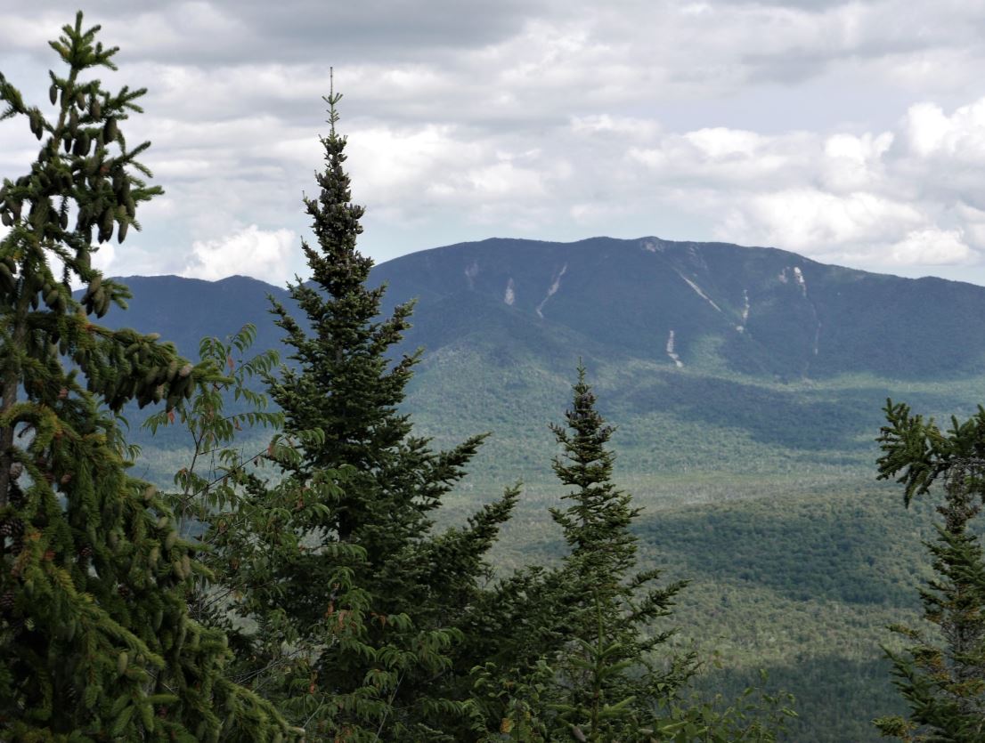
Moose Pond with Santanoni Peak in the background. The slide is well know to residents of the Long Lake/Newcomb area. You see it as you drive east towards Newcomb on Rte. 28N.