Showing posts with label Beech Bark Disease. Show all posts

Thursday, September 21, 2017

Schiehalion and The Birks of Aberfeldy

In my previous post I shared pictures and videos from an uncommonly picturesque hike up Ben Lawers. But Elle and I have done several hikes in the last few days. One, a walk nearly to the top of Schiehallion, a 3500 foot mountain, and, the other, on the route known as the Birks Of Aberfeldy. Both were fun and fascinating outings, if not quite as photogenic as Ben Lawers.

Schiehallion is a prominent mountain. On a clear day it can be seen from surrounding villages and from the A9 motorway that is the primary route into this part of the highlands. It's easy to get to and there is a large parking area (uncommon in these parts). These factors combine to make Schiehallion one of the most climbed mountains in all of Scotland. The day we were there the weather was by, Scottish standards, very good; heavy clouds, but no rain with temps in the 50s and only a light 20-30 mile per hour breeze. It was a Monday in mid-September but I'd estimate that 50 people reached the top that day.

The top of Schiehallion with a half mile left to go. 
The 3.5 mile trail is extremely well built and maintained; hardened against the feet of many hikers. The challenge in walking Schiehallion (the Scots don't say "climbing" unless there is a chance that a fall will kill you) is the elevation gain of 2500 feet. That, and the difficult footing encountered while crossing the extended boulder field near the top.

Elle showing the boulder walking form of an experienced hiller.

We stopped for lunch near this spot. With a quarter mile to go and maybe 100 feet left to climb. There were a dozen people on top and we found a nice place to eat lunch and enjoy the view. Peak bagging is a big thing in the Highlands with the Scottish equivalent of the "Adirondack 46er" club being to summit all 280 "Munros". In Scotland the "Munros" are peaks over 3000 feet in elevation. We, obviously, were not in it for that.
This is one of those cases where the pictures just can't do the view justice. We sat on a large rock with the Glen spreading below our feet. Elle kept telling me to get back from the edge and being appreciative of her walking the mountain with me I complied.

On the way down. All smiles with the tough stuff behind us.

Thought this was Heather but maybe not. Still trying to learn the scottish shrubaries.


Not sure what this is. Still looking for the name.

There was a subtle beauty in this scene that the picture only hints at. 


The Birks Of Aberfeldy

The "Birks of Aberfeldy" is the name given to a place, a trail, and a song (by young Robbie Burns). The song made the place famous but this would be a popular walk anywhere. Over one and a half miles you gain 600 feet of elevation up the steep gorge of Moness Burn (brook). And the trail leaves, literally, from the main street of Aberfeldy. No need for a village fitness trail when you've got this. At the very top the trail crosses a foot bridge with impressive Moness Falls directly below. 

Looking back down the Moness Burn towards Aberfeldy. Light rain was coming in. 
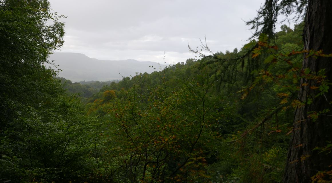
The gorge is lovely, but the forest is the best part. In gaelic 'ch' is replaced by 'k'. So 'birk' is 'birch' and the song is talking about the Birch trees seen along the way. Ironically, the birch trees seen along the trail are ho-hum by our Adirondack standards. But the beeches are incredible. The trail passes through stands of old growth Beech, Oak and a few other species. If you've followed this blog in the past you know that in the Adirondacks I'm always on the lookout for Beech trees that have survived Beech Bark Disease. I've now realized that what I thought were large, old, Beeches in the Adirondacks were middle-aged trees at best. The Beeches present along this trail are huge and have an ancient look to them. I'm slightly saddened to realize that there are no beeches in the Adirondacks that looks anything like these trees (they are the same species). It's easy to forget that the Adirondack forests we see today are a thin shadow of what existed just a few hundred years ago. I'm going back for pictures of these trees before we leave and I want to learn more about why the Beech trees here don't suffer from Birch Bark Disease.


Monday, May 1, 2017

Abner Brook and the Notch

Overall, the winter of 2016-2017 was mild. Storms in March and April moved the snowfall total towards the average but temperatures for the season were well above normal (1). So entering the last week of April spring was in full control of the southern Adirondacks. Over the past few years I've come to see early spring as a good hiking season with one potential drawback, mud. During the winter months moisture in the soil freezes and it takes a while when spring arrives for this frozen layer to thaw. Rain and snow melt can then saturate the ground above the frozen layer and creates the muddy mire we associate with "mud season". It's not pleasant to hike through and many unpaved roads are closed until May to prevent damage. Even so, if you exercise a little judgment you can get out during mud season in most areas without damaging the trails. Plus, if your timing is good, the Adirondack Protection Force (mosquitoes, black flies, and deer flies) will waiting for warmer days to come to launch their assaults on those who venture out.

Brand new signs clarify the options at the junction of the Godfrey Road access trail and the NLPT. 
My day started on the trail that leads from Godfrey Road to the Northville Lake Placid Trail (NLPT). At the trail junction just past the bridge over West Stony Creek I turned towards Woods Lake and the Benson Road. I had walked parts of this section previously. From this end on my way to Three Ponds Mountain and on a different day from the Woods Lake end turning back at Abner Brook. This left a two mile section along Abner Brook that I had not visited and still wanted to see. I planned to hike to the NLPT bridge over Abner Brook and then leave the trail and bushwhack over a ridge and into the valley of Notch Brook. A 19th century road passes up that valley and through a low pass immortalized on USGS topographic maps as "the notch". The old road would provide a route back to the NLPT and back to the car and, if time allowed, I wanted see what the "notch" looks like.

The red line is the NLPT section from Benson Road near Woods Lake (lower right) to the West Stony Creek North Branch Junction (at the sign post pictured above). The dark line is the route described in the story.  
The day went mostly as planned though I didn't go as far up the ridge as I thought I might. This was my first real outing of the season and the effects of winter were weighing on me. As it was, the route covered 10 miles with bushwhacking and route finding. A pretty good stretch of the legs.

Abandoned beaver ponds transition to swampy meadows. Beaver are a keystone species in the Adirondacks shaping the landscape and supporting ecological variety.  

Abner Brook just below the bridge on the NLPT. Abner Brook cuts a meandering path through a relatively flat valley creating ideal habitat for Beaver.  
This was not one of those hikes where a single place stands out as the "best" part of the day. It was, however, a warm, cloudless early-spring day with dry trails and no bugs. That combination is hard to beat. But, a few things are worth noting:
  • The Abner Brook Valley contains an extensive network of beaver meadows, swamps and ponds. This valley is a great place to see the full range of effects this creature has on the Adirondack landscape.
  • A cluster of large, healthy-looking, Beech trees on the Wallface Mountain ridge
  • A ravine with interesting talus slopes and a possible micro-climate
  • The tranquil beauty of the upper Notch Brook Valley

A bit of snow remained at the bottom of the small ravine I explored while crossing the Wallface ridge. The steep slope on the southern side of the ravine prevents direct sun from reaching the slope. Creating an environment that will on average remain several degrees cooler than surrounding terrain.

The ravine was perhaps most interesting. One hundred feet deep at most this glacial gouge is barely detectable on large scale topographic maps but quite striking as seen from the rim. The ravine crosses the ridge with an east-west orientation and the south-side bank is steep with a small cliff band at the top. Over the millennia since the last glaciation rocks and small boulders have fallen from the cliff band and created a talus slope. The orientation of the ravine means that even in high summer the sun will not reach the bottom until afternoon and further up the slope there are areas that probably never see direct sunlight. Winter comes early and spring arrives late in this micro-valley. And the talus that makes it rough going for hikers also limits the advance of soil and trees. magnifying the micro-climate effect. This is the kind of place where a botanist might look for uncommon plants.


Notch Brook. Late afternoon. April 24th, 2017. A perfect place for a short nap.

The Benson to Wells road crossed Notch Brook at this point and the abandoned road is easily distinguishable on the far side. Below this crossing (towards Benson) the road is still easy to follow though extensive blowdown results in many detours. Above the crossing the blowdown is even heavier and in places the old route becomes indistinct. I still didn't make it to the height of land in the "notch". Maybe next time.

The Adirondack wilderness is wild but it is not untracked. A cook stove near the abandoned Benson-Wells Road. 

Tree barnacles. Some kind of fungus seen on a downed tree at 1800 feet. Over a small area all the downed trees were covered with this growth. It may be common but I don't recall having seen it elsewhere. Maybe I just haven't noticed. 

Notes

1) Heating Degree Days for Glens Falls New York. In 2017 March was slightly colder than average but January and February were well below the 10 year average.

20172016201520142013201220112010200920082007Normal
January111211991545152113611207149013411624132412731450
February96010641621131911611046128910861213124813651222
March11188191189131810097181064783996106911621011

Sunday, March 27, 2016

County Line Lake

Sometimes things come together in unexpected ways and you just have to savor the moment. It was four PM and I had hiked to County Line Lake from the trailhead on Pinnacle Road (southwest of Benson NY). I'd scrambled part way up the small unnamed mountain north of the lake and now I was just a mile from the trailhead at the crossing of the northeast branch of Pinnacle Creek. Pausing, I was struck by what a perfect day it was. March 26th on the calendar but not the day I had expected. Temperature in the upper 40s. A brilliant blue cloudless sky. Not an annoying insect of any kind to be seen. And the transition from winter to spring nearly complete.

Route to County Line Lake from Pinnacle Road. The side trip to the right was to the vly that is the primary source of the NE branch of Pinnacle Creek. Image from Google Maps 

Ten hour earlier I had been drinking coffee and scanning a map of the southern Adirondacks looking for a place to get out for a hike. I always have a few options tucked away in the back of my mind but I was looking for someplace completely new. One of the things I love about the Adirondacks is that there are so many unique and interesting places to explore. And there it was; County Line Lake.

A small cascade on the slope of Pigeon Mountain.

As beautiful as the day was it's still March in the Adirondacks. The overnight temperature at 2500 feet had certainly dipped into the 20s. The light spray from a small cascade encased these leaves in ice.  


Beaver shape the Adirondack landscape. Pinnacle creek flows through a valley where Beaver create small ponds in an endless cycle of use and reuse. 

Most years on March 26th this area would still be firmly held in Winter's grasp with plenty of snow and ice. But the winter of 2015-2016 has not been most years. This winter is now in the books as one of the mildest since records have been kept here abouts. A few lonely patches of ice remain in sheltered places above 2000 feet, but very minimal. And, most remarkable of all, even the dreaded "mud season" has nearly past. In a typical winter the first couple feet of soil freezes solid. In the spring, after the snow melts, that frozen soil transitions first into a soupy mud; mud season. But not this year, for the most part this route has already dried out.

County Line Lake. March 26th, 2016. The lake sits at 2500 feet and, it was still iced over. But probably not for long. The ice was out on all the water lower down.
The namesake of this route, County Line Lake is pictured above. It's a decent sized body of water but I couldn't get a sense of the depth and it might be shallow. Bill Ingersoll notes in his Discover the Southern Adirondacks that the lake has been devoid of fish for many years. And that fits. The trail arrives at the southeast corner of the lake and basically just ends. The herd paths you typically find around a body of water that attracts fishermen and campers are not present. I crossed the inlet stream and fought through a quarter mile of brush along the north shore of the lake. From there I went up the slope of the unnamed mountain that borders the lake on the north. I wasn't looking to get to the top. I just wanted to avoid a return trip through the tangle closer to the shore. This strategy was only partly successful. The entire slope is brushy with almost no canopy sized trees.

At 2600 feet on the unnamed mountain north of County Line Lake. A snarled mess of stunted Beech saplings dominate this slope.
The forest on this slope is odd. I saw no signs of a blowdown event or fire or logging. But there are almost no large trees. The stunted trees visible in the photograph (above) are mostly American Beech and it may be that Beech Bark Disease has disrupted the normal cycle of forest succession. American Beech is a pioneer species and when the forest canopy is disturbed Beech quickly fill in. However, under some circumstances, Beech Bark Disease can kill the Beech trees before they get large enough to shade the soil so that moister loving species can get going. This can set up a cycle where Beeches fill in, die off, and fill in again. This creates a tangle of stunted Beeches that I have seen referred to as a "beech hell". Of course, that may not be what is going on at this location. The soil on this slope looked to be thin and the southwestern exposure had already left the slope bone dry. Interestingly, the few larger tree that are present (not tall but judging by the bark old) looked to be Black Cherry. Not sure what to make of that. I'd appreciate knowing the fire/logging history of this area to get a better sense of what might have led to the current state.
 
A beaver meadow on the inlet to County Line Lake. A short distance from the lake.

Along the inlet stream.

On my return trip I paid closer attention to the forest and it struck me that the lake is not the main attraction of this route (I might see that differently on a hot July day). The trail passes through stretches of attractive middle-aged forest with some large trees ( diameter > 30 inches) present. But it's the variety, the interesting terrain, and the streams that make this route the gem that it is.

Returning to where this tale began, sitting on the bank of Pinnacle Creek with the late afternoon light filtering through the trees, I was struck by the beauty of the spot. The first mile and a half of the route passes through a magnificent Hemlock forest; open, cool and inviting. Resting for a minute I didn't want the day to end. And hey, with three hours of daylight left why not follow the stream to it's source? Within 30 minutes I had reached the swampy vly that is the source of this brook. When the beaver have raised the water level this is probably a nice spot. But on this day the water level was low and the pond was surrounded by a mud flat. Not that it mattered. The 1/2 mile walk along the stream is as good as it gets. Through a deep hemlock forest along a brook with numerous cascades. After resting for a few minutes it was time to head for home.

Mallards on the shallow pond (vly) that is the source of the northeast tributary of Pinnacle Creek.


Friday, July 31, 2015

Wilcox Lake via Pumpkin Hollow


By the late 19th century the area north of Great Sacandaga Lake was dotted with hamlets and farms. Most of those homesteads are now gone -reclaimed by the forest-- but some of the forest roads that once connected them remain in use as trails. The Pumpkin Hollow trail to Wilcox Lake follows one of those routes.

Image One: From the Stony Creek USGS Historical Topographic map. 1:62500, 1910 Edition. The route to Wilcox Lake follows an old woods road from Willis Lake (on the left) to Wilcox Lake (top right).  


The 1994 ADK Guide to Trails of the Southern Region makes four observations about the Pumpkin Hollow trail to Wilcox lake:
  1. The trail passes through an attractive and maturing second growth forest.
  2. With the exception of eroded areas around Wilcox Lake the trail is in excellent condition.
  3. Parking at the end of the Pumpkin Hollow road is iffy. Good parking can be found at the Murphy Lake trail head but that option adds 1.5 miles (each way) to the route.
  4. There might not be a bridge over the Wilcox Lake outlet and crossing the stream in times of high water can be difficult.
As of July 2015 three of those four considerations remain true. This is a wonderful hiking route through an exceptionally attractive forest. The area around Wilcox lake does show scars from past motor vehicle access but the damage is fading. The choice on where to park remains the same but the bridge is not a problem. There is a good bridge over the outlet stream.

As part of the Forest Preserve the area around Wilcox Lake is classified as Wild Forest; a designation that allows for uses that are prohibited in wilderness areas and the Pumpkin Hollow trail is maintained (and marked) as a snowmobile trail. The ADK Guide notes that in past times vehicles reaching Wilcox lake from the Bakertown area caused extensive erosion on the hillside leading down to the lake. But I saw no sign of recent vehicle use and the eroded areas are recovering.

Image Two: Large Sugar Maple along the trail


The Trail and the Forest


The Pumpkin Hollow trail passes through an impressive, maturing, second-growth forest. With so many large trees present it appears that this area somehow escaped logging and fire reaching back into the 19th century. The forest contains a mix of species including Sugar Maple, Ash, White Pine, Hemlock, Birch and Beech.

Image Three: It's difficult to capture the 'feel' of a forest in an image (I'll have to work on this) but this is a rapidly maturing northern hardwood forest. For scale, the large tree on the right has a diameter of around 30 inches. This area contains trees that must be more than 150 years old. 


I found this forest to be particularly appealing because it looks like what I expect an undisturbed northern hardwood forest to look like. The presence of large trees of multiple species creates a dense canopy that limits the amount of light reaching the forest floor and that results in a relatively open forest understory. You can also see an open understory where stands of large Hemlock and White Pine are present but a mature hardwood forest has a different feel. When a large hardwood comes down it creates a big opening in the canopy and a variety of tree and shrubs species rush to take advantage of that. Over time these openings appear in a random pattern and you end up with a patchwork of open forest and dense little thickets. That is what I expect a climax stage northern hardwood forest to look like. Some areas along this trail have that appearance.

Particularly interesting is the presence of American Beech trees that have survived the initial kill-off caused by Beech Bark Disease (BBD). One Beech, with a diameter over 30 inches, may be the largest standing Beech I've seen since I started looking for them. Image Four shows this tree and while it looks pretty healthy my photo captured the tree's "good side". The back side of the tree shows extensive signs of BBD. One unfortunate aspect of BBD is that relatively healthy looking trees oftentimes fall victim to Beech Snap (Image Five). This happens because the disease weakens the trunk of the tree. So large trees with heavy canopies become vulnerable to breaking off in heavy weather. Beech snap is characterized by standing Beech trunks broken off cleanly 8 to 20 feet above the ground. Once you know what to look for you'll start to see these "snapped" Beech trees where ever mature Beeches were formerly present.

The large tree pictured in Image Four got me thinking about an intriguing possibility. This is the second large Beech I've seen that bears the unmistakable scar of a lightening strike. Could it be that a lightening strike kills the fungus (or the insects that spread it) giving the tree a better chance of fighting off BBD? If it takes being hit by lightening to survive then clearly it is not easy to be a Beech tree.

Image Four: A Large American Beech

Image Five: Beech Snap. Large Beech trees that appear to be holding their own against BBD can fall victim to Beech Snap. This occurs when a weakened tree is unable to support the weight of  its' canopy and the trunk snaps.


The Pumpkin Hollow trail also passes through an area where very large and old White Pines are seen. A number of trees with diameters greater than 36 inches are present and a few are approaching 48 inches. Trees of that size must be more than 150 years old and could be more than 200 years old. This got me thinking about the well-known Pine Orchard located just five miles north of the Pumpkin Hollow Pine stand. I've not yet visited the Pine Orchard but it would be interesting to compare measurements of trees from both areas. If the measurements show that the two sets of trees got going at about the same time it might shed some light on the history of this forest.

Wilcox Lake

Despite concerns about vehicle access and erosion Wilcox Lake is an attractive and worthwhile destination. As mentioned, eroded areas near the lake are starting to heal and the shoreline is in good shape. According to current maps there are two lean-tos at Wilcox Lake though that could change. The one that I visited is in bad shape and could topple over at any time. 

Image Six: Wilcox Lake

Image Seven: The eastern lean-to at Wilcox lake. It looks like the bottom tier of logs from this lean-to rotted out and that layer of logs was somehow removed. The current structure is not connected to the floor and the walls are leaning precariously. It looks like it could fall down at any moment.

Parking


Image Eight: You can park at the Murphy Lake Trail head on Pumpkin Hollow Road (far left) or you can drive past Willis lake and try to make your way to the small parking area found where the red and blue lines meet on the map.
You have a choice to make when deciding where to park. There are signs and good parking at the Murphy Lake trail head on Pumpkin Hollow Road. As seen on the map (Image eight) this parking area is at the far left where the red line begins. If you start hiking at that point you'll walk the road past Willis Lake and up a couple of hills. After a mile and a quarter you'll come to a couple of camps on the left. Just past the second camp the road narrows and gets much rougher. From there it's another 1/4 mile to a small parking area and the DEC barrier at the start of the trail part of the Wilcox Lake trail (roughly 5.5 miles to Wilcox Lake from there).

Or, you can drive that same route. From Willis Lake to the camps the road is in pretty good shape but there's no clearly safe place to park along that section. Once you pass the camps the road is not at all car friendly and the last hundred yards or so before the parking area is extremely rough. I inched my Subaru Forester toward the parking area and found a decent place to pull off just at the point where I couldn't go any further. Which was good because backing out was going to be very difficult.


Saturday, July 4, 2015

Burnt Mountain; Bushwhacking to an Interesting Summit Near Long Lake

As with Fishing Brook Mountain, Burnt Mountain is visible from Route 28n just east of Long Lake. It's a small peak --just 2600 feet-- and it would go mostly unnoticed except for the areas of open rock that are clearly visible near the summit. I have long wondered about the view from those rocks. Given that the summit is less than a mile (as the crow flies) from the Long Lake Reservoir I figured it could be done in a few hours; maybe a half day.

Taking advantage of the 4th of July holiday I set off to see. Turns out there are very good views. From the summit the view to the north is mostly open and with some exploring good views can be found for nearly every direction. I was a bit over optimistic on the difficulty however; the trip was not quite the half day outing I had expected. The seven mile round trip took 6 hours of nearly continuous walking and by the end I was very happy to see the car. Pretty much every bushwhacking trip I take turns out to be harder than expected. Maybe there's a lesson to be learned from that. Nah, the next one is bound to be easy.

From the summit of Burnt Mountain. Looking Northeast towards the High Peaks.
From the summit of Burnt Mountain, looking Northwest; Click on the photo to see the full size image and you can just make out a sliver of Long Lake in the upper left. Kempshall Mountain is the prominent rounded mountain in the right center with Blueberry Mountain just to its' left. Blueberry Mountain is another one of those trail-less and infrequently climbed peaks with great views. In the full image you can make out some of the south facing open areas on Blueberry mountain. And there are extensive open rock areas on the west side with great views of Long Lake.

From an opening on the south side of Burnt Mountain looking Southwest towards the west end of the Fishing Brook Range. 

Overview of the route. The first mile and a half is along the Northville Lake Placid Trail (NLPT) from Rte 28n. On the way up I passed the Long Lake Reservoir and walked due east until the slope steepened and turned south to angle towards the notch. For the return I followed the small brook that flows out of the notch on the south side of Burnt Mtn. down to Sandy Creek. Crossing the creek I continued west until I ran into the NLPT. As the day warmed the flying vermin started to find me in large numbers and I was highly motivated to find a trail where I could move along at a quicker pace. (image from Google Earth) 
Google Earth terrain view showing my circuitous route around the summit in more detail. The open rock on the left seemed like a good bet for by-passing the conifer thickets seen here in darker green, but the rock was a little steeper than liked for a solo bushwhacking trip so I beat my way through a lot of brush.

I hiked up to the notch on the south side of the mountain (on the left) and climbed up to the summit from there.  That route  was steep and passed through areas of dense thicket. Seeking an easier route I came down the east ridge (on the right). That way was much easier but left a climb of a couple hundred feet back up to the notch.  

It may be that the easiest route up Burnt Mountain is not up from the notch on the south but instead would work around the mountain on the north side and up the northeast slope to the top (upper right in the photo). The second growth forest on the north side of the mountain is Beech-Maple though nearly all of the large Beech trees have succumbed to Beech Bark Disease (BBD). Still, the forest is relatively open and easy to navigate with large Maples and Yellow Birch that I estimate to be in the 80-100 year age range. The only issue with climbing the mountain from the northeast is that the state land boundary crosses Burnt Mountain just east of the summit. So staying on public land might force you onto a less desirable route.


Spiders gotta weave

As always I was on the lookout for ecological anomalies. I didn't spot anything really notable but the notch on the south side of the mountain is pleasant and feels remote. The forests south of Rte. 28 are mostly mature second growth consisting primarily of Sugar Maples, Yellow Birch, Hemlock and on the higher slopes, Spruce. Many trees have reached full height with ABH diameters greater than 24 inches with a smattering of older trees with diameters approaching 36 inches. One notable tree was a Beech seen on the northwest slope of the mountain with a diameter of 36 inches. It was tipped up from the roots sometime in the past year or so but it looked to have been in good shape when it went over. The wood was still sound and there was very little indication of BBD. Had I seen it before it went over it would have been a notable specimen.

One final note; my father grew up in Long Lake and hunted in these woods as a young man in the 1950s. He tells me that there is an interesting cave somewhere in the notch on the south side of Burnt Mountain. No doubt the forests are much thicker there now because I saw no sign of it. Maybe next time.