I had forgotten about the circus that emerges spontaneously in the High Peaks on a holiday weekend. I've done plenty of hiking in the high peaks but in recent years I've avoided the region almost entirely. Somehow it never occurred to me that my plan, a long walk to the Cold River along the northern edge of the Seward Range would pass straight through the melee.
 |
| The High Peaks Wilderness region is rugged and strikingly beautiful but not particularly wild. However, this intersection, near the place where I turned around, is about as far away from civilization as you can get in the Adirondacks.Several trail systems come together in this vacinity but no trailhead is less than nine miles away. |
It used to be the that the "Sewards" were remote and untrailed. And these four remote mountains represented one of the stiffer tests to be overcome by a potential '46er'. But these days the access trails are much improved and what were once herd paths up the mountains are now well worn trails. Even so, I was caught off guard at finding 50 or so cars already present in the parking area at 8:00 am on a Saturday morning. I really should have known; labor day weekend with a darn near perfect weather forcast; cloudless sky, 70 degrees, low humity - Jackpot! Seeing all the cars I considered heading for a different trailhead but if I did no one would know where I had gone so I stuck with the plan and headed out. And despite the overflowing parking lot I didn't encounter a single person on the first leg of the trip; the 4.5 mile walk to the Blueberry lean-to. The scene at the lean-to, however, brought a chuckle. I counted 11 tents in the vacinity of the lean-to and a half dozen packs inside. But it was quiet and there was no one around. The tents and gear belonged to what I imagined must have been a parade of hikers setting off a couple of hours earlier to bag the peaks.
Beyond the Blueberry lean-to this route passes --in succession-- the intersection with the Ward Brook Truck Trail, the Ward Brook Lean-to, and the two "Number Four" lean-tos. The Number Four location is 6.5 miles from the parking lot and it also features a horse coral though I saw no evidence that any horses had recently come along to enjoy the spot. The "number four" that gives this place its' name is seen on old topograpic maps. The spot is marked simply as "Camp" on the 1923 edition of the 1:62500 scale USGS map but that was changed to Camp No. 4 on the 1930 edition. To distinguish it from other camps shown on the maps one might suppose.
 |
| The 1930 edition of the 1:62500 USGS topographic map of the area. Camp No. 4 is a little right of and below the center of the image. This image was taken from a map available from the USGS Topoview map repository. |
Also seen on the map is something called the "Government Trail". That "trail" at some point became the Ward Brook Truck Trail connecting roads in the Ampersand Lake area with Duck Hole and probably the mines and iron works at Tawhaus further to the southeast. The trail from the Number Four lean-tos to the Cold River follows this truck trail and the abandoned gravel roadway provides an excellent base for walking. These "truck trails", found throughout the Adirondacks, were mostly built in the 1930s as Civilian Conservation Corp projects or in the years immediately following World War Two. Most have deteriorated badly in the 50 years since maintenance ended but this one has held up very well. In particular, the bridges that span the many brooks and streams were well built and only a couple are starting to sag. The
story of the truck trails can be found on-line and it represents an early battle over how the forest preserve was to be managed.
 |
| Intersection where the Sewards trail joins the Ward Brook Truck Trail. |
 |
| The Ward Brook Truck Trail follows a well build gravel road all the way to Duck Hole. This photo was taken from the same location as the one above (looking in the opposite direction). From this point it's .7 miles to the Ward Brook Lean-to and an additional .7 miles to the two "Number Four" lean-tos. The trail is smooth and well traveled to that point. Past the last lean-to the forest is closing in and the trail narrows to a footpath. |
 |
| Past the last lean-to the road narrows to a path and it takes on a distinctly wilder feel. But this was a well built road as evidenced by this bridge nearly eight miles distant from the trailhead. When this road was in use it reached all the way to Duck Hole and every brook and stream was spanned by a sturdy bridge. |
The hike to the Cold River and back covered a bit over 19 miles. That's a long way to walk by any standard but the relatively smooth made it a bit easier than it sounds. Much of the day passed in the solitude that I enjoy on these long outings but at the very end of the day a lost dog brought me back to earth. Over the last few miles of my return trip I had passed two backpackers, a man first and then a ways further on a woman, both looking for their lost dog. The dog had run off and not returned and while the man looked worried the young woman --forlornly calling her dog's name into the woods-- was clearly stressed. They were asking every hiker to be on the lookout for the black dog with the yellow kerchief.
Continuing out to the road I found that the dog had returned to the trail head parking area where it was crouching next to the couple's car; peeking out to see if one of its' humans had returned. The dog also was stressed and, despite assurances from the woman that the dog was super friendly, any approach closer than a few feet brought a growl. Luckily a second hiker, who had also heard the story and, most importantly, was much younger than I am, volunteered to go back up the trail to fetch the woman. Not wanting to chance the dog doing something even crazier I sat on a log and waited; trying all the while to coax the dog over to me with some carrot sticks (that being the only edible item left in my pack after a ten hour hike). But the dog was having none of this. So we waited. After a while we heard voices and the dog went to full alert. When moments later the woman and the second hiker appeared in view there was a most joyous reunion. The dog sprinting to greet her and then coming back to me as if to say, "I wanted to be friends with you but I wasn't sure". With carrot sticks laying about on the ground I explained that I was trying to lure the dog over, to which the woman replied that the dog was "not vegetarian". This slightly ridiculous exchange flowed out of the overwhelming sense of relief and joy that everyone was feeling at that moment. We didn't know what to say. In thanking us the the woman made the point of saying that she if had a million dollars she would have handed it to us on the spot. Failing that she added that she would find a way to thank us by "paying it forward". Ah, joy.
What a wonderfully odd but happy way to end the day.
 |
| A water strider enjoying a stroll on one of the numerous streams that flow down out of the Sewards. |
 |
| Now walking with a friend. |
 |
| One of the numerous streams that are the primary appeal of this route. |
 |
| The three mile stretch from the last lean-to to the NLPT trail junction is remote and wild. |
 |
| Sturdy bridge over Moose Creek. Just above the confluence with Cold River. |
 |
| Moose Creek looking towards the Cold River Confluence. |
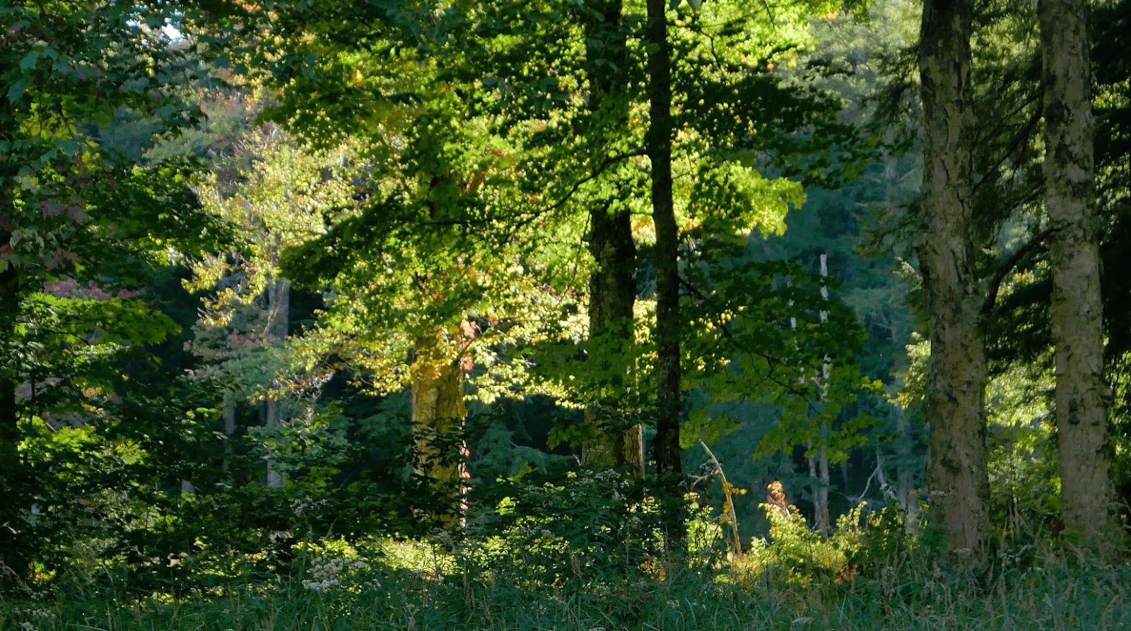
 |
| The flora of the Adirondack forest is a big part of what makes it feel like home for me. |
 |
| There's no substitute for late afternoon light. |