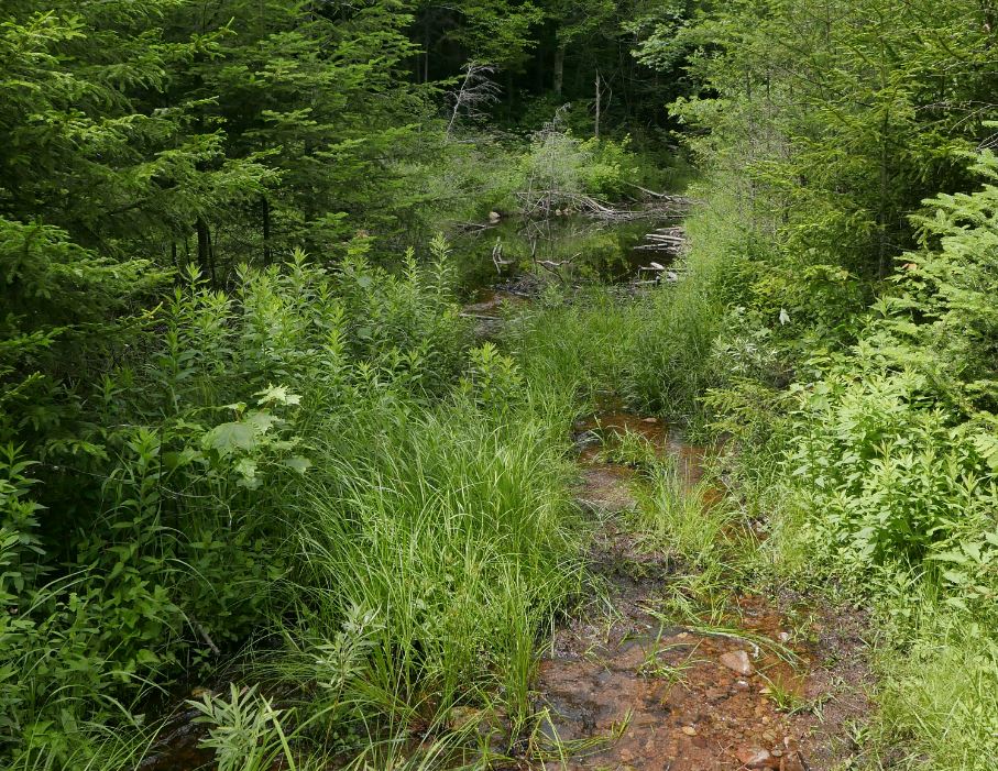
The little used Otter Brook trail provides access to trails east of Cranberry Lake and ultimately to the heart of the Five Ponds Wilderness. Starting at a gate and small parking pullout on Otter Brook Road (Four miles beyond Horseshoe Lake; Accessible from Rte 421 South of Tupper Lake) the trail follows an abandoned logging road for two miles to a junction with the Chair Rock Flow trail. This is the point where you would turn off if your intent was to journey into the Five Ponds region. The other way leads to a second trail system known as the Dog Pond Loop. I went that way, passing Dog Pond and Irish Pond before reaching Curtis Pond. Returning the way I had come made for an eleven mile round trip.
 |
| Otter Brook Trail and the region east of Cranberry Lake. (Map Image from Google Earth) |
 |
| Approaching Dog Pond. Beaver have created a series of small ponds in the gully where the trail previously ran. |
 |
| Irish Pond between Dog Pond and Curtis Pond. Irish Pond may be the most scenic of the three named ponds you pass on this route. |
The first section of this route passes through a recovering forest with ample evidence of the logging that took place before the state acquired the land. The route follows an abandoned logging road which is filling in rapidly with ferns and grasses or with brush and small trees depending on how might light is coming through the canopy. The road was well built, so the trail is easy to follow, but this section shows no signs of regular use.
 |
| A section of trail flooded by beaver activity. |
Which gets us to the bear. Rounding a corner where the trail enters an old logging clearing you can look out over a large beaver meadow. As I entered the clearing my eye was drawn to movement about 100 yards away. The source of that movement was a full grown Black Bear. You don't often see bears out and about during the daytime and, even less common, this one didn't react at all to my arrival. The bear's head was down and it was digging at something. It was clear that the bear had no sense that I was there.
This was largely the result of the unusual weather conditions. Normal, I probably wouldn't hike this route in early July. Hiking the swampy --buggy-- country of the western Adirondacks in July can be a test of one's patience. But a strong cold front had moved through the area the night before with heavy rain and wind. The forecast called for blustery winds for most of the day and on that basis I had decided to give this route a try.
 |
| One of several unnamed beaver enhanced ponds passed along this route. |
And that prediction was holding up nicely. A steady breeze with occasional strong gusts kept the bugs at bay and I realized that it had also prevented the bear from detecting my approach. I was straight downwind from the bear and it had not heard me coming. Even so, after a minute the bear gave up on the digging and ambled into the forest at the edge of the meadow. Which presented a problem. If the bear continued on the same path it would cross the trail about 100 yards ahead of me. With thick brush crowding the trail on both sides I could see maybe halfway to the point where that meeting might be expected to take place and it then occurred to me that the bear and I might meet at a point with limited visibility and with the wind blocking news of my arrival by sound or scent. That did not seem like a great idea.
Reflecting on this I decided that my best bet was to make a lot of noise; to reduce the chance of a surprise encounter. As I started walking I shouted a couple of times, and whistled, but it's hard to decide what to shout. That's when I thought of the music player in my phone.
Firing up the music app the last song that had played was the Grateful Dead classic Ripple. Perfect! What better song for a windy, gloomy, day with a bear lurking in the woods. I set the song to playing at the highest volume my phone could muster and continued on with a watchful but less nervous eye on the woods. After walking for a few minutes I had nearly forgotten about the whole affair when I come upon a large pile of bear poop right in the middle of the trail. Not exactly steaming, but clearly deposited since the rain had stopped only a few hours before. I hope the bear enjoyed the brief musical interlude that I provided.
 |
| An old growth Yellow Birch. A tree like this is certainly a couple hundred years old and maybe older even than that. |
The rest of the hike was uneventful and it was indeed a good day for this route. The wind blew steadily and the route grew more interesting with each passing step. Past Dog Pond the trail reaches a second junction at a place named Proulx Clearing. I headed southeast towards Curtis Pond or you could turn to the north to connect with the trails near Cranberry lake and eventually Route 3. Along the way to Curtis Pond the trail passes several remote ponds as it passes through mature forests on land that has been owned by the state for well over 100 years. Irish Pond is particularly attractive and a small point provided an idyllic setting for lunch.
 |
| Less than a half mile past Dog Pond the trail reaches a junction at a place called Proulx Clearing. Site of an abandoned lumber camp. |
 |
| A Tamarack swamp just a hundred yards from the start the trail. The route passes at least a dozen swamps and beaver ponds in addition to the larger named water bodies. |