In my previous post I shared pictures and videos from an uncommonly picturesque hike up Ben Lawers. But Elle and I have done several hikes in the last few days. One, a walk nearly to the top of Schiehallion, a 3500 foot mountain, and, the other, on the route known as the Birks Of Aberfeldy. Both were fun and fascinating outings, if not quite as photogenic as Ben Lawers.
Schiehallion is a prominent mountain. On a clear day it can be seen from surrounding villages and from the A9 motorway that is the primary route into this part of the highlands. It's easy to get to and there is a large parking area (uncommon in these parts). These factors combine to make Schiehallion one of the most climbed mountains in all of Scotland. The day we were there the weather was by, Scottish standards, very good; heavy clouds, but no rain with temps in the 50s and only a light 20-30 mile per hour breeze. It was a Monday in mid-September but I'd estimate that 50 people reached the top that day.
The top of Schiehallion with a half mile left to go.
The 3.5 mile trail is extremely well built and maintained; hardened against the feet of many hikers. The challenge in walking Schiehallion (the Scots don't say "climbing" unless there is a chance that a fall will kill you) is the elevation gain of 2500 feet. That, and the difficult footing encountered while crossing the extended boulder field near the top.
Elle showing the boulder walking form of an experienced hiller.
We stopped for lunch near this spot. With a quarter mile to go and maybe 100 feet left to climb. There were a dozen people on top and we found a nice place to eat lunch and enjoy the view. Peak bagging is a big thing in the Highlands with the Scottish equivalent of the "Adirondack 46er" club being to summit all 280 "Munros". In Scotland the "Munros" are peaks over 3000 feet in elevation. We, obviously, were not in it for that.
This is one of those cases where the pictures just can't do the view justice. We sat on a large rock with the Glen spreading below our feet. Elle kept telling me to get back from the edge and being appreciative of her walking the mountain with me I complied.
On the way down. All smiles with the tough stuff behind us.
Thought this was Heather but maybe not. Still trying to learn the scottish shrubaries.
Not sure what this is. Still looking for the name.
There was a subtle beauty in this scene that the picture only hints at.
The Birks Of Aberfeldy
The "Birks of Aberfeldy" is the name given to a place, a trail, and a song (by young Robbie Burns). The song made the place famous but this would be a popular walk anywhere. Over one and a half miles you gain 600 feet of elevation up the steep gorge of Moness Burn (brook). And the trail leaves, literally, from the main street of Aberfeldy. No need for a village fitness trail when you've got this. At the very top the trail crosses a foot bridge with impressive Moness Falls directly below.
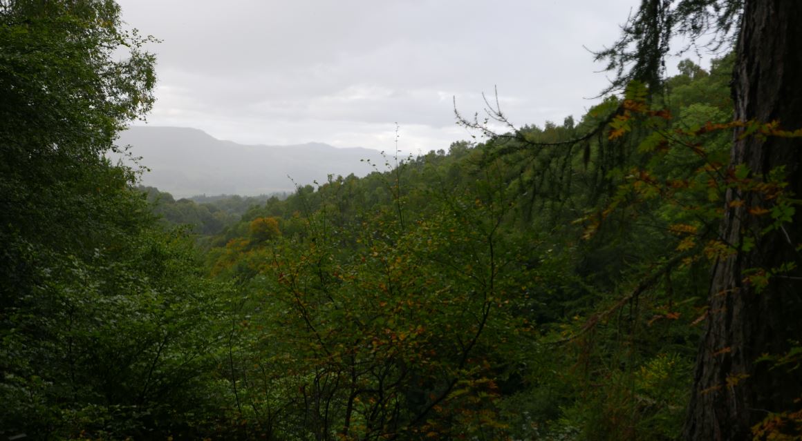
Looking back down the Moness Burn towards Aberfeldy. Light rain was coming in.
The gorge is lovely, but the forest is the best part. In gaelic 'ch' is replaced by 'k'. So 'birk' is 'birch' and the song is talking about the Birch trees seen along the way. Ironically, the birch trees seen along the trail are ho-hum by our Adirondack standards. But the beeches are incredible. The trail passes through stands of old growth Beech, Oak and a few other species. If you've followed this blog in the past you know that in the Adirondacks I'm always on the lookout for Beech trees that have survived Beech Bark Disease. I've now realized that what I thought were large, old, Beeches in the Adirondacks were middle-aged trees at best. The Beeches present along this trail are huge and have an ancient look to them. I'm slightly saddened to realize that there are no beeches in the Adirondacks that looks anything like these trees (they are the same species). It's easy to forget that the Adirondack forests we see today are a thin shadow of what existed just a few hundred years ago. I'm going back for pictures of these trees before we leave and I want to learn more about why the Beech trees here don't suffer from Birch Bark Disease.
It's the middle of our week long stay in Aberfeldy and everything has been fantastic, including the hiking. I'll write more about the whole trip in the near future but wanted to do a quick post to share pictures and video.
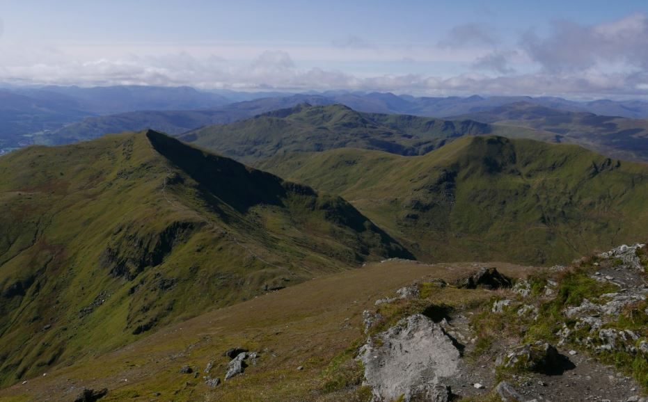
From the top of Ben Lawers looking back at Beinn Ghlas
The forecast called for a crystal clear autumn day but we've been hiking, or walking, every day since we arrived and Elle wanted a rest. So off I went off to hike up Ben Lawers; the 10th highest mountain in Scotland at 3985 feet. The pictures will tell the story, but a few details might help.
The route starts at 1000 feet and tree line in Scotland is considered to be between 1500 and 2000 feet. That said, below tree line the mountains are mostly swathed in heather with only small trees and shrubs present. This is mostly the result of centuries of sheep grazing and above the lowlands trees are present only where the sheep are fenced out.
The views are expansive the whole way up Ben Lawers. The route I took first crossed a second peak, Beinn Ghlas (3500 feet). From there you drop down to a col (pass) and then up Ben Lawers. I went over the top of Ben Lawers and down to a second col with the intention of also going up a third peak named An Stuc. But, reaching the col, and looking at the up --and down-- my old knees would be required to endure to climb the third mountain, I thought better of it. So I headed back up and over the top of Ben Lawers and down to the col between Ben Lawers and Beinn Ghlas. From there a different track returns to the car park. It was just stunning the entire way. The entire covered about 8 miles with 4000 feet of elevation gain.
Half a mile from the car park, looking up at the summit of Beinn Ghlas
From the second col, looking back up at the top of Ben Lawers. The trail climbs up the rocks to the left and up over the top of Lawers.
This may have been my favorite part of the whole day. The trail passes around the end of the ridge in a long gentle descent back to the car.
Labor Day weekend. The weather forecast called for a high of 65 degrees, low humidity and clear skies. Setting out to hike to Tioga Point on Raquette Lake, Elle and I had high hopes. We were not disappointed. This is an uncommonly pleasant route walked on day that can only be described as 'perfect for hiking'.
The route begins on North Point Road, southwest of Long Lake. From the road it's two miles to Lower Sargent Pond and four additional miles to Tioga Point. We actually turned back just short of the campground at Tioga Point but it didn't matter. This hike is all about the journey, not the destination.
We had our lunch on the shore of Eldon Lake which I thought was Raquette Lake. And it's a mostly arbitrary distinction. Eldon Lake is a mile long bay separated from the main body of the big lake by a sandbar and shallow water. Whether it's a bay, or a separate lake, depends on the water level.
Overview of the route. A campground (boat access only) is located on Tioga Point. Eldon Lake, and the sandbar that separates it from Raquette Lake, is visibly just below the line representing our route. The old growth stands discussed in this post are about half way between Lower Sargent Pond and Eldon Lake.
1909 USGS topographic map. Eldon Lake is named on the map despite the direct connection with Raquette Lake.
Grass Pond seen on the way to Lower Sargent. Shallow and non-descript, Grass Pond will be most interesting to birders. We spotted two Gray Jays and a large owl (most likely a Barred Owl)
The trail to Lower Sargent Pond gets plenty of use but from Sargent Pond to Eldon Lake the trail has a wilderness feel. The route is marked as a snowmobile trail but there is a good foot path the entire way with just a couple wet areas that might be problematic when it's really wet.
Trail side on the walk to Lower Sargent Pond.
The route passes several attractive bodies of water but the main appeal is the forest itself. From the road to Lower Sargent Pond you walk through a maturing hardwood forest with large Yellow Birch dominating the canopy. That usually means that at some point in the past the area was lightly cut with only the softwoods being taken (Pine, Spruce and Fir were the first choice of early Adirondack loggers). Even so, given the overall maturity of the forest, this tract must have been added to the forest preserve early on.
The trail crosses the brook that drains the Sargent Ponds into Raquette Lake just before you reach the short spur trail to Lower Sargent. The outlet of Lower Sargent Pond joins this stream just beyond this point, and a fish dam blocks access for fish making their way upstream from Raquette Lake.
Lower Sargent Pond. The Sargent Ponds are known for good fishing and good swimming. You can reach the ponds from several different access points and there are two trailheads on North Point Road. One leads to Lower Sargent Pond and the other goes more directly to Upper Sargent. A loop hike with a 1.5 mile road walk between the trailheads is possible. We did that loop a couple years ago and that hike is described here.
The fish barrier dam at Lower Sargent Pond prevents undesirable fist species present in Raquette Lake from entering the pond. Lower Sargent Pond hosts a good trout fishery.
The walk to Lower Sargent makes for a great short hike, but it's the forest between Lower Sargent and Eldon Lake that is so spectacular. Leaving Lower Sargent the forest composition initially remains much the same; mature, second growth hardwoods. But after a mile or so the forest composition changes dramatically. The first thing I noticed was the presence of large Maples. I had not been seeing any of those. And then the old growth White Pine and Spruce appeared.
The trekking pole I'm holding was set at 135 centimeters or 53 inches. Standard practice is to measure tree diameter 4 feet above the ground. I was holding the pole higher than that to make it more visible. The diameter of this Pine at four feet is about 50 inches.
For half a mile the trail passes through what appears to be old growth; possibly never cut. There are dozens of White Pine that I place in the "wow, that's a really big tree" category. An informal measurement of one Pine near the trail found the diameter to be 50 inches (AVB) and numerous equally large specimens can be seen. Large hardwoods: Yellow Birch, Maple and Ash are mixed in and 18 inch diameter Red Spruce are also seen. That's big for the slow-growing Red Spruce but I didn't see any of the 24 inch diameter trees you might expect to find in undisturbed old growth. It may be that the large Spruce and Fir were cut from this area at some point or maybe conditions here are not as attractive for the pulpwood species. One thing I can say with certainty. This section of forest is distinctly different than what is commonly seen. You'll know it right away.
When we first saw Eldon Lake I thought it was Raquette Lake. Some maps show this water as an arm of Raguette and some show it as a separate water body.
I generally avoid the Eastern High Peaks. Many areas lack the solitude and wildness that I find appealing. But you can't beat a great view and I've long been intrigued by a small peak south of Mt. Marcy named the Pinnacle. The Pinnacle sits at the western end of the range that includes Nippletop, Colvin and Blake. At just 3400 feet Pinnacle avoids the 46er curse, and there's no easy way to get there, so even on a gorgeous late summer day crowds seemed unlikely.
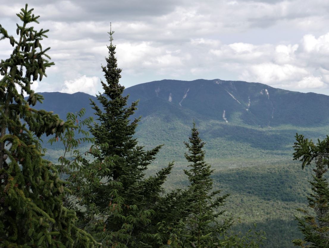
View from near the top of the Pinnacle. The Great Range (L. to R.): Mt. Marcy, Haystack, Basin, Saddleback, Gothics. Ausable Lakes in the foreground.
The route follows the Panther Gorge Trail from the Dix Mountain Trail head at Elk Lake. The Panther Gorge trail starts across the road from the parking area (the Dix Trail goes off separately) and provides a southern approach to the highest peaks. Using this trail it's ten miles to the summit of Marcy and this is probably the least used approach to the Great Range. After five miles on the Panther Gorge trail you reach the junction with the Pinnacle Trail and it's an additional 1.8 miles to the top from there. The Pinnacle trail is rough, but relatively level, until after a mile you reach a junction with a private trail coming up from the Adirondack Mountain Reserve. That's where the climb begins. From there you'll gain 1300 feet of elevation in the remaining eight tenths of a mile to the top.
This route does not get a lot of use. I walked it on a perfect late August day and met two people on the trail for the entire day. However, I did see plenty of other hikers. I got a late start and by the time I got to Elk Lake the Dix trail head parking was full (no parking is allowed along the road). This meant that I (and many many others) had to park two miles back along the road at Clear Pond. The extra two miles on both ends of the hike meant that my planned 14 mile hike was going to be an 18 miler. The two extra miles went by quickly in the morning but, at the end of the day, walking slowly back along the road with darkness falling, I was afraid to stop. Not afraid of the dark, but afraid that if I sat down I might not be able to get started again. I got back the car at 8:00 pm after 10 hours of continuous hiking. In addition to the distance, the trail crosses the Colvin Range ridge (in both directions) so total elevation grain for the day was 4300 feet. All in all, one of toughest hikes I've done in recent years.
The lay of the land (screen capture from Google Earth).
One of the highlights of the day was catching glimpses of what I believe were several (two, possibly more) Bicknell's Thrushes near the summit of Pinnacle (3400 feet). This secretive bird breeds at high elevations in the northeastern U.S. and Canada and, with a very limited breeding range, it is rather rare. Bicknell's is not easily identified in the field but these birds were definitely thrushes and, given the location, Bicknell's Thrush is the likely ID.
Viewed on a map, or in Google Earth, the Pinnacle is a non-descript bump on a ridge surrounded by much bigger mountains. But, as for views, this is a giant. There are fantastic views of the Great Range and crossing the summit there are views of the Dix Range and Elk Lake. The pictures tell the story.
Elk Lake. Looking southeast from the Pinnacle.
The ADK Guidebook says that the trail climbs steeply at times. This nearly vertical ladder near the top qualifies as "climbing steeply".
Mount Marcy (left) and Haystack. The rocky knob of Little Haystack is seen on the far right.
Mt. Macomb. The other Dix range peaks are visible though the trees from the summit of Pinnacle.
Looking south towards Hoffman Mountain and the peaks of the Blue Ridge Range.
Another shot of Marcy and Haystack. With the Upper Ausable Lake just visible in the foreground.
The Pinnacle trail (1.8 miles from the Panther Gorge Trail to the top) passes though a magnificent hardwood forest. Ancient Yellow Birch with diameters approaching 4 feet are seen along with old growth Maple. The Spruce near the summit appear to be untouched by loggers or fire with numerous large trees present.
No Adirondack hike is complete without encountering an odd fungus along the trail. Despite the distinctive color, and an unusual foul odor, I've not been able to identify this particular variety.
The Northville Lake Placid Trail (NLPT) is not a route for peak baggers. Unlike many other long distance hiking routes, the NLPT does not follow the spine of a mountain range. Instead, the NLPT crosses the adirondack dome via natural corridors provided by the many rivers and streams that define the landscape. Nearly the entire route stays below 2500 feet, with one prominent exception. The section south of Route 28N (east of Long Lake) crosses a steep ridge line at just over 3000 feet.
Walking south on the NLPT from the parking area on 28N, it's 3.5 miles to the ridgeline with 1300 feet of climbing. You ascend gradually for the first three miles and a good chunk of the elevation is gained in the last half mile. The trail then follows the ridgeline for half a mile before dropping off steeply to begin the descent towards Tirrell Pond and points south. I've hiked in this area many times but it's been years since I walked along the ridgeline in mid-summer. What a shame. The half-mile along the crest of the ridge is an uncommon delight.
Spruce, Fir and other common sub-alpine species mix-in, but the canopy along the ridgeline is dominated by Yellow Birch.
Three thousand feet is not high, even by modest Adirondack standards, but the forest community present on this ridge is uncommonly attractive. Above 2800 feet, on the northern side, the forest canopy is dominated by mature Yellow Birch with an understory consisting primarily of fern-filled meadows. This is not a named ecological assemblage (NYS Natural Heritage Project) and this elevation is considered to be the upper limit for Yellow Birch.
I spent two hours exploring the ridge line and simply sitting, relaxing, and enjoying the solitude.
Ecological communities are highly variable. There are the defining characteristics of a locale: climate, soil, moisture levels, elevation, slope, and so on, but these characteristics simply provide a baseline. The forests we see today have been shaped by disturbances: disease, fires, storms, droughts and logging. I suspect that the forest present on the ridgeline southeast of Long Lake emerged from an event that took place on November 25, 1950. If you know anything of recent Adirondack history that date should ring a bell. That's the date of the great Adirondack hurricane. What locals refer to simply as the 'blowdown'.
We tend to think of hurricanes as tropical storms but the storm that blew through the Adirondacks on that November day exhibited the same characteristics; heavy rain and intense cyclonic winds formed around a compact low pressure area. With recorded wind speeds of up to 100 miles per hour, this storm would been memorable under any circumstances, but the effects were greatly magnified by the wind direction. Any large tree growing in the Adirondacks has stood fast against many storms and, over time, the trees brace themselves against the prevailing northwesterly winds. The 1950 storm battered the forests from the south and, worst of all, the northeast. Those northeasterly winds hit trees growing on north facing slopes particularly hard and in some places 50 to 75% of the mature trees came down.
Yellow Birch dominate the canopy and ferns fill the understory.
White Pine and Spruce tended to be most vulnerable and on the other end of the spectrum Yellow Birch tends to hold up well against high winds. If you're unfamiliar with Yellow Birch you might be wondering how birch trees could be so tough. The White and Grey Birch so common in suburban yards are the first trees to come down in a storm. Well, we can't pick our relatives, and Yellow Birch is an entirely different sort of tree. Yellow Birch is long-lived and specimens of Yellow Birch are among the oldest and largest trees present in Adirondack forests today. The ridge line southeast of Long Lake was hard hit by the 1950 storm and the mature Yellow Birch present there today prospered in the aftermath of that storm.
The Adirondack forest is damp and mossy. A few degrees warmer, and with a few more inches of rain annually, and the Adirondacks would be a temperate rain forest. Maybe that's what it will become in the future.
If the ridge line is out of reach the first mile of this trail passes through a large Spruce bog of uncommon diversity and beauty. I've walked the boardwalks of this section dozens of times but I enjoy it every single time. The picture is of water flowing in Shaw Brook. Roughly a half mile from the trail head.
Ghost plant (Indian Pipe) is a heteromycotroph. These plants lack chlorophyll and derive energy from fungus in the soil.
The Roosevelt Truck Trail (RTT) is a hidden gem. That's what I told Elle as we drove out of Long Lake headed towards Newcomb. I was confident that the 'hidden' half of that statement was true. As for the 'gem' part, we would soon find out.
I use that route when driving from Long Lake to our home in Saratoga Springs and I've wondered about a narrow paved road that disappears into the forest on the north side of Route 28N, five miles east of Newcomb. The road is easy to miss, but the railroad track that once connected the mines at Tahawus with North Creek provides a good reference point. The road enters the forest a quarter mile east of the tracks. The road looks like it could be a driveway, but there is little sign of use and no electricity or phone lines reach out this far. Recently, I read about a unique trail that leaves 28N somewhere in that vicinity. Putting two and two together, this intriguing little road had to be the Roosevelt Truck Trail.
Good parking is found at the southern end of the RTT. The trail runs for 2.5 miles from Rte. 28N to the Blue Ridge Road.
For much of the way the route follows a well maintained woods road. The northern end, however, is blocked by blowdown and is heavily grown in.
Ironically, there actually is a house on the access road. A short distance in a gravel driveway leads off of the paved road but, continuing on, you soon reach a small parking area with signs indicating that you are on forest preserve land. A wide woods road with a heavy gate leads north out of the parking area. This is the truck trail.
The RTT runs for two and half miles between Rte. 28n and the Blue Ridge Road. From the south, the first half of the route is well maintained and about a mile in you reach two well manicured camp sites. These sites are designated as handicap accessible. With a permit, and the combination for the locked gate, a four wheel drive vehicle could be driven to these sites. Located in a stand of mature white pines this would be a very nice place to camp. You'd need to bring water however, there does not appear to a nearby source.
Done as an out and back hike the entire route covers five miles over gently rolling hills. The only complication comes at the northern end. There is considerable blowdown north of Vanderwacker Brook and the road is more grown in.
The RTT is popular with bird watchers and it was a write up describing a guided hike taken by a bird watching group that led us there. We saw plenty of birds but nothing uncommon. However, as the day warmed, we saw plenty of the most common forms of flying Adirondack wildlife. It being July the mosquitoes and deer flies kept us moving along at a brisk pace the entire way.
The route is noted for its' passage through boreal forests and that is part of its' appeal. A snowshoe hare in brown summer time garb crossed the path in front of us and it's easy to imagine Bobcats stalking prey in these woods. But, as is the case for many parts of the Adirondacks, past human activity has directly shaped what we see today. The southern end of the trail passes through homogeneous stands of non-native Norway Spruce. This forest was planted with the fast growing European spruce to replace the harvested native trees. Judging by the size this was probably done in the 1920s or 1930s.
Is the RTT a gem? Sure, it's a quiet walk through maturing forests with great bird and wildlife watching opportunities. Like many Adirondack trails it would probably be best walked in the fall, but those who appreciate solitude it's worth a visit at any time of year.
Late July along the RTT. The trail is mostly open and easy to walk. The half mile south of the Blue Ridge Road is grown in.
Light passing through the web creates a moire pattern.
Early morning light. We got out early on an unusually cool morning in late July (48 degrees in Long Lake). This was to reduce our encounters with the air wing of the Adirondack Protection Force.
It was a cool morning but Elle was bundled up against the bugs, not the cold. By Adirondack standards they actually weren't bad. The northern part of the route is grown in with lots of blueberries. Also lots of poison ivy so watch out for that.
Two camp sites with good access and new, accessible, privies are available for back country camping with a degree of handicapped access.
When the State established the Whitney and Round Lake Wilderness areas in 1998 some of abandoned logging roads that crisscross the area were marked as trails. And while I've canoed and camped on the big lakes that define this area: Little Tupper, Round Lake, Rock Pond and Lake Lila, I had never found a reason to hike those trails.
In part that's because before the former Whitney lands were added to the Forest Preserve the area was heavily logged and these forests will need another 50 years to recover their full stature. On top of that there's the issue of distance. Bum Pond, the closest of the destinations reached by trail, is over five miles from the trailhead and the other ponds you might want to visit require round trips in the 15 to 17 mile range.
But now I had a reason to go (which I'll get to in a minute). So, starting at the Burn Road parking area on the Sabitis Road, I set off for Hardigan Pond south of Little Tupper Lake. The Burn Road trail follows what was previously a well built logging road and its' purpose is to get you to the southern end of Little Tupper lake (which despite the name is six miles long). After about five miles on the Burn Road trail you reach the first of the side trails that can be taken to reach Bum Pond, Lilypad Pond, Rock Pond, and Hardigan Pond. You can also access the shore of Little Tupper itself at several points along the way.
My motivation for walking this route on a beautiful Sunday in July was rain. The preceding weeks had been exceptionally rainy, even by Adirondack standards, and trails everywhere were flooded and muddy. I knew that Charley Pond Stream, the only substantial stream in the first five mile stretch along the Burn Road, was spanned by a substantial bridge. With streams running at spring flood levels throughout the Adirondacks I figured the Burn Road would be relatively dry. Turns out, this was only partially true. On this particular weekend, the Adirondacks were soaked.
Charley Pond Stream just below the bridge on the Burn Road. The water on this day (7/2/2017) was exceptionally high following two weeks of heavy rains.
The bridge over Charley Pond Stream is just under four miles from the trailhead and a mile past the bridge the trail reaches the first junction. This side trail (also following what was once a gravel road) heads east toward Bum Pond and the former site of Bliss Camp on the south shore of Little Tupper Lake. The junction is marked by an ancient sign post with a homemade sign on which someone has written "Bliss", with an arrow pointing the way. Given that this is the only destination in the area likely to get any traffic, I should have realized that this might not be a good omen.
My intended destination was Hardigan Pond; a trek of 8.5 miles (each way). That's about my distance limit but old roads usually provide easier walking and, if conditions were good, I figured I could make it (and still be able to walk back out). But the extremely wet conditions posed challenges even on this relatively dry route. The first of which was a large beaver pond just two miles in. The pond covered an extended section of the trail and the rains had swelled the pond out into the forest in all directions. The terrain at the spot the beaver selected is particularly rough and rocky, and getting around the flooded area led me through a dense spruce thicket and I still got my feet wet crossing a large a marshy area. And this little detour ate up a lot of time.
Bum Pond, in the William C. Whitney Wilderness just south of Little Tupper Lake.
But an even bigger issue loomed past the Bum Pond junction. When these trails were laid out they followed well traveled gravel roads, and there was little need for marking. Today, after the passage of 20 years, waist high growth fills every clearing and the old logging roads that crisscross the area all look alike.
A mile past the Bum Pond/Bliss Camp junction the trail reaches a junction with the single DEC sign I spotted anywhere along this route. The sign pointed the way towards Rock Pond and Hardigan Pond and I knew that the route straight ahead continued on to Lillypad Pond. I headed towards Hardigan and, from that point on, there were no signs or trail markers. There was also no indications that anyone goes this way. Following the old road through the wooded sections was easy enough but at one large clearing brambles and weeds had filled in to the point that I was unsure which of the three old roads leaving the far side of the clearing was the actual trail. And I picked the wrong one. After a half mile I realized that I was heading in the wrong direction and turned back. Backtracking to the clearing, and coming at it from that alternate direction, the main route was obvious. Beginners mistake.
By now it was too late to make Hardigan Pond but there was one more complicating factor. Have you ever seen a movie from Siberia or Alaska with people surrounded by a cloud of mosquitoes? It was now early afternoon, and quite warm, and I must have been the tastiest creature to come this way in a while. Even drenched in deet the mosquitoes were attacking in waves and were way past being just annoying. It was time to head back.
Along the way I took the one mile side trip to Bum pond and the Bliss Camp site, and both are worth a visit. Resting and enjoying a swim in Little Tupper made the five+ miles back along the Burn Road much more enjoyable.
Bum Pond southwest of Little Tupper Lake.
Little Tupper Lake from the former Bliss Camp landing. Back in the 60s and 70s Bliss Camp was an in-holding in the Whitney property and a substantial "camp" (private home) was located at this spot. Later, a hunting and fishing club had a camp here as well. The buildings are long gone and, other than some open areas rapidly filling in with small trees and early successional growth you wouldn't know that buildings were once located here.
A small pool along the Burn Road was filled to the brim and based on the population of large polliwogs the local frog population will soon be greatly increased. I had stopped to try to get a picture of a snapping turtle that I noticed sitting on this submerged log, but the turtle spooked and all I could get were the soon to be frogs.
In one respect the Burn Road, and the young forests it passes through, are exceptional. This area is an excellent place to see wildlife and birds. Moose and bear had left calling cards along the trails and I saw a number of birds that are harder to spot in more mature forests.
Eastern BlueBirds (nesting)
Cedar Waxwings
Ravens
Yellow Bellied Sapsuckers
Turkey Vulture
Great Blue Heron
White Crowned Sparrows
Ruffed Grouse
And of course Blue Jays, thrushes and other ubiquitous species
Footnotes:
Locals refer to this as the Burn Road but the DEC calls this the Lillypad Pond Trail.
Three things stand out about the East Stony Creek Trail to Wilcox lake:
This is one of the best hiking routes in the southern Adirondacks
East Stony Creek is noisy and beautiful
The intense green of the Adirondack forest in mid-June
At various points during the day the black flies also got my attention, but I'll forget that part soon enough.
East Stony Creek. This location is 1.5 miles from the parking area and from this spot to the bridge the trail is within sight (or sound) of the creek the entire way. On the day I was there the creek was running high following three weeks with substantial rainfall.
Just below the hiking bridge that provides access to Wilcox Lake.
This trail was previously marked for snowmobiles but blue markers have recently been added to designate the route for hikers. In the past there were parking complications at the trail head but a new parking area solves that problem. From the parking area hikers should continue along the road for four tenths of a mile and pick up the trail at the end of the road (where parking is now prohibited). The rest of the route is unchanged and the first quarter mile crosses private land with the permission of the land owner (so stay on the trail). The old trail to Tenant Creek Falls, which also crossed private land, is now closed. A new route to Tenant Creek Falls leaves directly from the new parking area.
From the new parking area it's 4.2 miles to suspension bridge over East Stony Creek. From that point it's one more mile to Wilcox Lake but you could choose to skip that part. The creek and forest you pass through along the way are well worth the walk. After crossing the bridge the mile of trail to Wilcox Lake is heavily eroded and Wilcox Lake itself has suffered from overuse in the past. That said, it's an attractive lake and I've been there twice and not seen a soul either time.
The newly built parking area is located on Hope Falls Road .4 miles from the end of the road (and the previously used parking). The trail to Tenant Creek Falls, which previously started at the end of the road, has been re-routed and leaves directly from the new parking area. That new trail is not shown on map above. You can see the new route here on the DEC website.
Green. Deep, intense green. In June the Adirondacks are a temperate jungle.
The East Stony Creek trail is within sight of the creek for much of the way and it is an exceptionally attractive path. The forest is mature second growth composed mostly of Hemlock with hardwoods mixed in. The high canopy, and open forest floor, provide a feeling of remoteness.
Green
Wilcox Lake from the point where the trail reaches the lake. A pair of loons were hanging out in the small bay to the left of where this was taken. A side trail leads to a nice lean-to on that side of the lake. To the right a path leads to the site of a new lean-to build in 2016 to replace the one that I visited the year before. The old one had stood for several years on the verge of collapse.