Monday, September 26, 2016

Whitehouse to Piseco on the NLPT

The six mile stretch of the Northville Lake Placid Trail from the Whitehouse parking area north to Piseco doesn't get a lot of use. The first 3/4 mile stretch sees day hikers headed for the side path to Big Eddy on the Sacandaga West Branch but beyond that there's nothing special about this section of trail. Hamilton Lake Stream (2 miles) is attractive, as is Priests Vly (3.2 miles), but most hikers using this route are backpackers.

Late afternoon sun along the Sacandaga West Branch. A glorious early fall day in the southern Adirondacks.
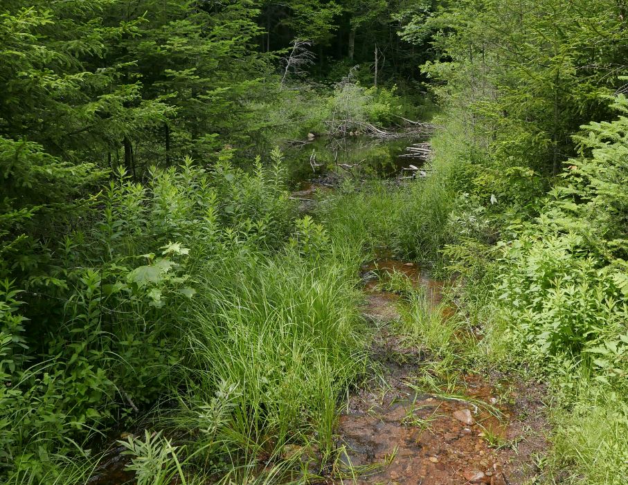
Near the far end, a mile short of where the NLPT crosses Rte.8 at Piseco, the trail crosses the outlet stream from Buckhorn Lake. The lake --shallow and swampy-- lies just a quarter mile off the main trail and while the lake is uninspiring the stream and surrounding woods are very attractive. This area has several nice camping spots and it seems likely that local people use the spot for day hikes and camping.

My hike from Whitehouse to Piseco and back, with side trips to Buckhorn Lake and Big Eddy, covered just under 15 miles. Most of this walk was in complete solitude through a rapidly maturing second growth forest. Keeping the hiker's creed in mind --start slow, taper off-- it took me nearly 9 hours to cover the distance. I walk slowly studying the forest and the mix of trees that make up the canopy. The hardwood forests of the southern Adirondacks are dominated by a few species: Maple, Yellow Birch, Ash and Hemlock. Where these trees have reached full height but with diameters commonly less than 30 inches (4 feet above the ground), I take it to mean that the area was probably logged early in the Adirondack industrial logging period. That period ran from roughly 1860 until the early twentyeth century and the southern forests were scoured for valuable timber first. If these assumptions are correct then canopy trees present today have been growing for 120 to 150 years. I have no formal training in forestry but that age estimate fits with trees that have attained full height but that are not yet middle aged. Much like people, middle aged and elder trees have greater diameters and they eventually take on a grizzled and worn look.

And the forests seen along this trail do contain some elder trees, so even if my logging assessment is generally correct the logging was probably done selectively. The largest and oldest trees, some with diameters over 40 inches, are mostly Maples with some Yellow Birch and Hemlock mixed in. This is typical of areas in the southern Adirondacks where White Pine, Spruce and Hemlock were sought out and taken but where hardwoods were sometimes ignored. In those days softwoods were prized but hardwood timber was available in more accessible locations.

The more adventerous part of my day came near the end. With less than a mile remaining on the return leg I left the main trail and followed the well-worn path towards Big Eddy on the Sacandaga. Then, as I approached the river, I foolishly came up with the idea that it would be nice to see something off the beaten path. So I left the trail seeking to bushwhack to the place where Hamilton Lake Stream joins the river just downstream from the "eddy". The water in both streams is exceptionally low this year --following a hot, dry summer-- and the undergrowth near the confluence is deep and thick. And swampy, really really swampy. I realized pretty quickly that my route was poorly choosen but I didn't want to turn back without at least seeing the river so I plowed on through. After 30 minutes of muddy, itchy, bushwhacking I had indeed seen the river and I was back at the place where I had left the trail. And that was a good thing. It was 5:30, I still had a mile and half back to the car, and I was moving rather slowly. Start slow, taper off.

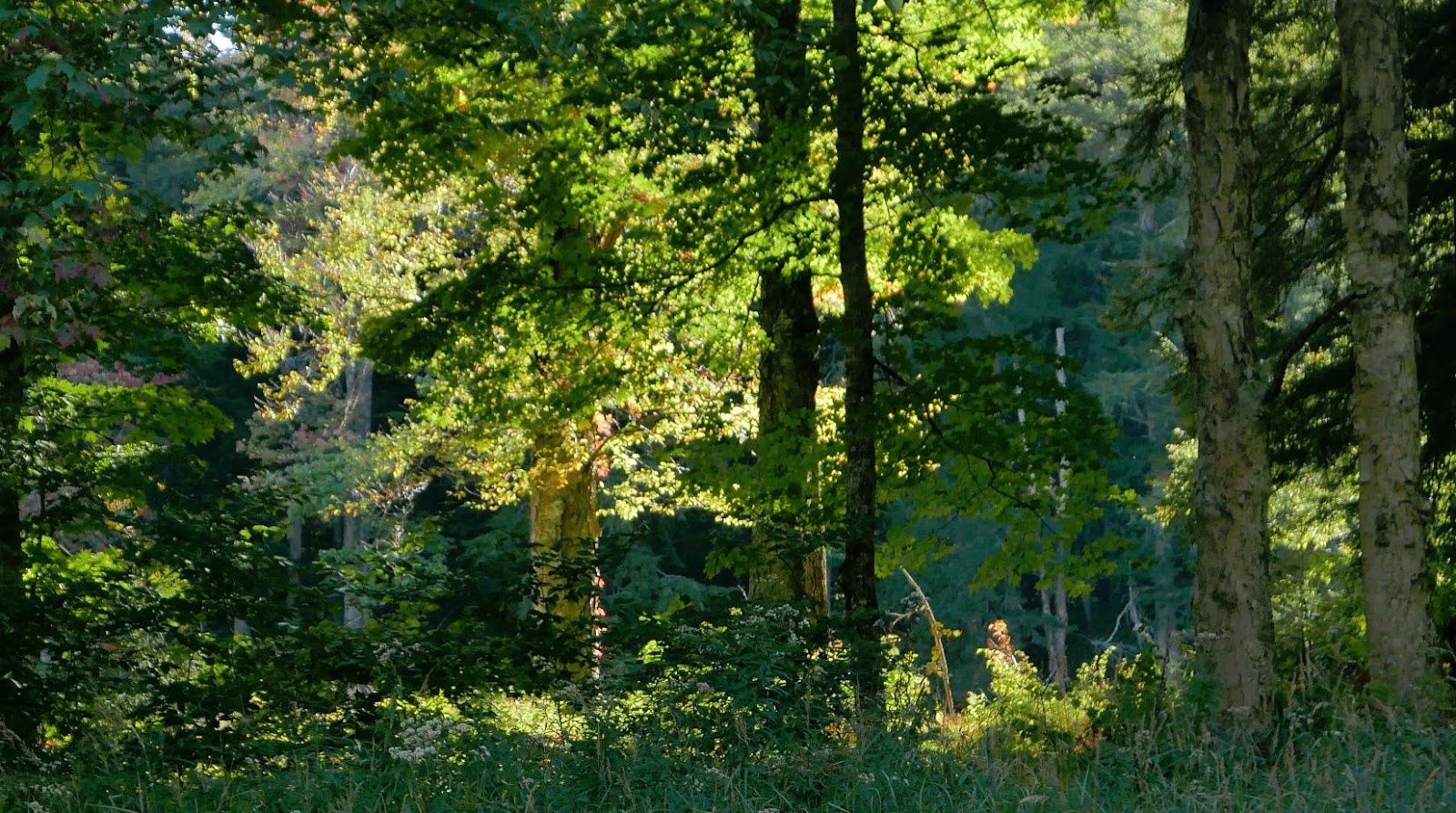
Forest scene along the NLPT north of Whitehouse.
Another forest scene along the NLPT north of Whitehouse.
Hamilton Lake Stream from the bridge. Low water in late September of a dry year.
Priest Vly
Buckhorn Lake
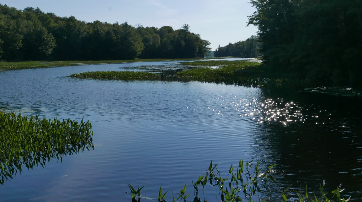
Sacandaga West Branch just above the point where Hamilton Lake Steam enters.

Fading light, time to head for the car.


Monday, September 5, 2016

Cold River via the Ward Brook Truck Trail

I had forgotten about the circus that emerges spontaneously in the High Peaks on a holiday weekend. I've done plenty of hiking in the high peaks but in recent years I've avoided the region almost entirely. Somehow it never occurred to me that my plan, a long walk to the Cold River along the northern edge of the Seward Range would pass straight through the melee.

The High Peaks Wilderness region is rugged and strikingly beautiful but not particularly wild. However, this intersection, near the place where I turned around, is about as far away from civilization as you can get in the Adirondacks.Several trail systems come together in this vacinity but no trailhead is less than nine miles away. 
It used to be the that the "Sewards" were remote and untrailed. And these four remote mountains represented one of the stiffer tests to be overcome by a potential '46er'. But these days the access trails are much improved and what were once herd paths up the mountains are now well worn trails. Even so, I was caught off guard at finding 50 or so cars already present in the parking area at 8:00 am on a Saturday morning. I really should have known; labor day weekend with a darn near perfect weather forcast; cloudless sky, 70 degrees, low humity - Jackpot! Seeing all the cars I considered heading for a different trailhead but if I did no one would know where I had gone so I stuck with the plan and headed out. And despite the overflowing parking lot I didn't encounter a single person on the first leg of the trip; the 4.5 mile walk to the Blueberry lean-to. The scene at the lean-to, however, brought a chuckle. I counted 11 tents in the vacinity of the lean-to and a half dozen packs inside. But it was quiet and there was no one around. The tents and gear belonged to what I imagined must have been a parade of hikers setting off a couple of hours earlier to bag the peaks.

Beyond the Blueberry lean-to this route passes  --in succession-- the intersection with the Ward Brook Truck Trail, the Ward Brook Lean-to, and the two "Number Four" lean-tos. The Number Four location is 6.5 miles from the parking lot and it also features a horse coral though I saw no evidence that any horses had recently come along to enjoy the spot. The "number four" that gives this place its' name is seen on old topograpic maps. The spot is marked simply as "Camp" on the 1923 edition of the 1:62500 scale USGS map but that was changed to Camp No. 4 on the 1930 edition. To distinguish it from other camps shown on the maps one might suppose.

The 1930 edition of the 1:62500 USGS topographic map of the area. Camp No. 4 is a little right of and below the center of the image. This image was taken from a map available from the USGS Topoview map repository.

Also seen on the map is something called the "Government Trail". That "trail" at some point became the Ward Brook Truck Trail connecting roads in the Ampersand Lake area with Duck Hole and probably the mines and iron works at Tawhaus further to the southeast. The trail from the Number Four lean-tos to the Cold River follows this truck trail and the abandoned gravel roadway provides an excellent base for walking. These "truck trails", found throughout the Adirondacks, were mostly built in the 1930s as Civilian Conservation Corp projects or in the years immediately following World War Two. Most have deteriorated badly in the 50 years since maintenance ended but this one has held up very well. In particular, the bridges that span the many brooks and streams were well built and only a couple are starting to sag. The story of the truck trails can be found on-line and it represents an early battle over how the forest preserve was to be managed.

Intersection where the Sewards trail joins the Ward Brook Truck Trail.

The Ward Brook Truck Trail follows a well build gravel road all the way to Duck Hole. This photo was taken from the same location as the one above (looking in the opposite direction). From this point it's .7 miles to the Ward Brook Lean-to and an additional .7 miles to the two "Number Four" lean-tos. The trail is smooth and well traveled to that point. Past the last lean-to the forest is closing in and the trail narrows to a footpath.

Past the last lean-to the road narrows to a path and it takes on a distinctly wilder feel. But this was a well built road as evidenced by this bridge nearly eight miles distant from the trailhead. When this road was in use it reached all the way to Duck Hole and every brook and stream was spanned by a sturdy bridge.
The hike to the Cold River and back covered a bit over 19 miles. That's a long way to walk by any standard but the relatively smooth made it a bit easier than it sounds. Much of the day passed in the solitude that I enjoy on these long outings but at the very end of the day a lost dog brought me back to earth. Over the last few miles of my return trip I had passed two backpackers, a man first and then a ways further on a woman, both looking for their lost dog. The dog had run off and not returned and while the man looked worried the young woman --forlornly calling her dog's name into the woods-- was clearly stressed. They were asking every hiker to be on the lookout for the black dog with the yellow kerchief.

Continuing out to the road I found that the dog had returned to the trail head parking area where it was crouching next to the couple's car; peeking out to see if one of its' humans had returned. The dog also was stressed and, despite assurances from the woman that the dog was super friendly, any approach closer than a few feet brought a growl. Luckily a second hiker, who had also heard the story and, most importantly, was much younger than I am, volunteered to go back up the trail to fetch the woman. Not wanting to chance the dog doing something even crazier I sat on a log and waited; trying all the while to coax the dog over to me with some carrot sticks (that being the only edible item left in my pack after a ten hour hike). But the dog was having none of this. So we waited. After a while we heard voices and the dog went to full alert. When moments later the woman and the second hiker appeared in view there was a most joyous reunion. The dog sprinting to greet her and then coming back to me as if to say, "I wanted to be friends with you but I wasn't sure". With carrot sticks laying about on the ground I explained that I was trying to lure the dog over, to which the woman replied that the dog was "not vegetarian". This slightly ridiculous exchange flowed out of the overwhelming sense of relief and joy that everyone was feeling at that moment. We didn't know what to say. In thanking us the the woman made the point of saying that she if had a million dollars she would have handed it to us on the spot. Failing that she added that she would find a way to thank us by "paying it forward". Ah, joy.

What a wonderfully odd but happy way to end the day.

A water strider enjoying a stroll on one of the numerous streams that flow down out of the Sewards.

Now walking with a friend.


One of the numerous streams that are the primary appeal of this route.
 
The three mile stretch from the last lean-to to the NLPT trail junction is remote and wild.

Sturdy bridge over Moose Creek. Just above the confluence with Cold River.

Moose Creek looking towards the Cold River Confluence.

The flora of the Adirondack forest is a big part of what makes it feel like home for me.

There's no substitute for late afternoon light.


Sunday, August 21, 2016

Rock Pond, Cascade Pond and Stephens Pond

Leaving the Rock Pond trailhead on Durant Road (Blue Mountain Lake) this route visits three interesting ponds; any one of which is a worthy destination. Rock Pond, which is connected to Lake Durant by a quarter mile long flow, is less than a mile from the parking pullout. The trail crosses over the flow on a long bridge with Blue Moutain visible over the trees. This is a lovely spot and, despite being close to the road, it does not bear the scars of overuse seen in many similar places.

From the bridge over the flow that connects Rock Pond and Lake Durrant. This is looking back towards Lake Durrant.
From Rock Pond it's two miles further to Cascade Pond which,takes its' name from the rocky cascades on the outlet stream just below the pond. After crossing the steam on a narrow log bridge the trail descends slightly into a rocky flooded meadow. It's easy to lose the main trail here and end up at the nearby lean-to. If you find yourself at the lean-to, turn left. The main trail passes through the woods 75 yards behind the lean-to.

The bridge over the Cascade Pond outlet stream.
From Cascade the trail soon reaches an intersection with the NLPT. Following the NLPT south brings you to Stephens Pond a little more than a mile from Cascade. Stephen's pond also has a good lean-to and it is sure to be popular with NLPT thru hikers.

Stephens Pond from near the lean-to.

From Stephens Pond I followed the Northville-Lake Placid Trail (NLPT) south for a couple of miles. I was considering the possibility of visiting the ridiculously obsure Dish Rag Pond, But, it was two and a half miles further and continuing would have meant a 19 mile round trip instead of the 14 miles I was already committed to. Too far on a very warm and muggy day. Tiny, swampy, Dish Rag pond will have to wait.

The NLPT south of Stephens Pond passes through wild and little visited forests, some of which appear to be old or very mature second growth. One stretch passes through an uncommonly open forest with a high canopy composed entirely of hardwoods including some very large Ash specimans. At first I thought the unusual forest composition was the result of selective logging. But if that was the case stumps should be evident and I didn't see any. There are many decaying logs from large downed trees indicating a blowdown event. Based on the apparent age it's a reasonable guess that these trees might have come down in the 1995 storm. Perhaps this is an area where the winds of that day produced moderate and somewhat selective damage. That's the best theory I could come up and I'm looking for a high resolution map of damage areas to see if effects in this area were noted at the time. While searching online I did stumble on a fascinating journal article describing the 1995 blowdown and the policy debates that followed.

I also came upon this document. Everything you could possibly want to know about Derecho storms.

The route from Google Earth. Blue Moutain Lake Village is top left. The yellow lines are DEC trails in the area. The orange line is the route described in the article.


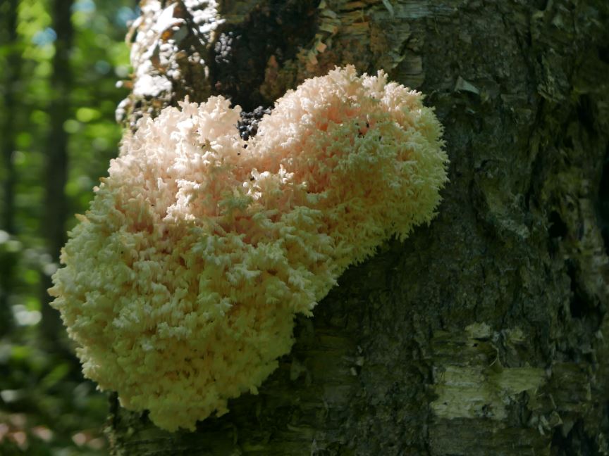
Fungus growing on a tree near the trail.


Sunday, August 7, 2016

Hoffman Notch

We've recently started taking the Blue Ridge Road when traveling between Saratoga Springs and Long Lake. Going that way I couldn't help but notice the DEC trail sign about five miles from the Northway at Exit 29. When I got around to looking on a map I realized that this was the northern end of the Hoffman Notch trail. I say 'realized' because I could vaguely remember reading about the route in Barbara Martin's mother of all Adirondack hiking guides, 50 Hikes in the Adirondacks.

Much of the first mile of the route at the northern end crosses a flat bottom-land. This is prime beaver territory with every stage of beaver altered landscape present. The various meadows and small ponds provide views of the nearby Washburn Ridge.

A forest scene along the way.


Big Marsh provides good views of the mountains to the east. As of August 2016 beaver have backed the water up so that it covers the trail in a few places.

Numerous signs of past activity, including logging, are seen along the way.


Hoffman Notch Brook is a particularly attractive stream. And in the Adirondacks that's saying a lot.

From the northern terminus the trail runs for a little over seven miles to an even more obscure trailhead west of Schroon Lake. There's no particular destination reached by this trail and, given that both McMartin (writing in the mid-90s) and the current DEC website note that sections of the trail are commonly flooded by beaver activity, it's little wonder that the trail gets very little use.

From the parking area on the Blue Ridge Road the trail descends slightly into the broad bottom land where several brooks join up to form "The Branch" - one of the two feeder tributaries of the Schroon River. This is one of the sections where beaver commonly flood the route but, in early August of 2016, the water was low and the passage was dry. That first mile of trail passes through private land until at about a mile you reach a sturdy bridge over Hoffman Notch Brook. Just past the bridge the trail enters the Hoffman Notch Wilderness. From there the trail climbs gradually into the notch following the brook for much of the way. At about 3.5 miles Big Marsh is reached with good views of the mountains to the east.
The "notch" is valley between ridges. The valley floor is filled by a series of beaver ponds and meadows.
Past Big Marsh the water flows the other way (south) with the marsh providing a primary source for the North Branch of Trout Brook. From there the trail passes by and through a succession of beaver ponds and meadows eventually reaching a junction with the Big Pond trail at six miles and the southern parking area at 7.2 miles.

If hiking through a little visited and rugged landscape --with absolutely no destination in mind-- appeals to you, this route is a hidden gem. So many places to explore and so little time. Sigh.


Friday, July 8, 2016

Dog Pond to Curtis Pond and How I Introduced a Bear to the Grateful Dead

The little used Otter Brook trail provides access to trails east of Cranberry Lake and ultimately to the heart of the Five Ponds Wilderness. Starting at a gate and small parking pullout on Otter Brook Road (Four miles beyond Horseshoe Lake; Accessible from Rte 421 South of Tupper Lake) the trail follows an abandoned logging road for two miles to a junction with the Chair Rock Flow trail. This is the point where you would turn off if your intent was to journey into the Five Ponds region. The other way leads to a second trail system known as the Dog Pond Loop. I went that way, passing Dog Pond and Irish Pond before reaching Curtis Pond. Returning the way I had come made for an eleven mile round trip.

Otter Brook Trail and the region east of Cranberry Lake. (Map Image from Google Earth)


Approaching Dog Pond. Beaver have created a series of small ponds in the gully where the trail previously ran. 
 
Irish Pond between Dog Pond and Curtis Pond. Irish Pond may be the most scenic of the three named ponds you pass on this route.
The first section of this route passes through a recovering forest with ample evidence of the logging that took place before the state acquired the land. The route follows an abandoned logging road which is filling in rapidly with ferns and grasses or with brush and small trees depending on how might light is coming through the canopy. The road was well built, so the trail is easy to follow, but this section shows no signs of regular use.

A section of trail flooded by beaver activity.

Which gets us to the bear. Rounding a corner where the trail enters an old logging clearing you can look out over a large beaver meadow. As I entered the clearing my eye was drawn to movement about 100 yards away. The source of that movement was a full grown Black Bear. You don't often see bears out and about during the daytime and, even less common, this one didn't react at all to my arrival. The bear's head was down and it was digging at something. It was clear that the bear had no sense that I was there.

This was largely the result of the unusual weather conditions. Normal, I probably wouldn't hike this route in early July. Hiking the swampy --buggy-- country of the western Adirondacks in July can be a test of one's patience. But a strong cold front had moved through the area the night before with heavy rain and wind. The forecast called for blustery winds for most of the day and on that basis I had decided to give this route a try.

One of several unnamed beaver enhanced ponds passed along this route.
And that prediction was holding up nicely. A steady breeze with occasional strong gusts kept the bugs at bay and I realized that it had also prevented the bear from detecting my approach. I was straight downwind from the bear and it had not heard me coming. Even so, after a minute the bear gave up on the digging and ambled into the forest at the edge of the meadow. Which presented a problem. If the bear continued on the same path it would cross the trail about 100 yards ahead of me. With thick brush crowding the trail on both sides I could see maybe halfway to the point where that meeting might be expected to take place and it then occurred to me that the bear and I might meet at a point with limited visibility and with the wind blocking news of my arrival by sound or scent. That did not seem like a great idea.

Reflecting on this I decided that my best bet was to make a lot of noise; to reduce the chance of a surprise encounter. As I started walking I shouted a couple of times, and whistled, but it's hard to decide what to shout. That's when I thought of the music player in my phone.

Firing up the music app the last song that had played was the Grateful Dead classic Ripple. Perfect! What better song for a windy, gloomy, day with a bear lurking in the woods. I set the song to playing at the highest volume my phone could muster and continued on with a watchful but less nervous eye on the woods. After walking for a few minutes I had nearly forgotten about the whole affair when I come upon a large pile of bear poop right in the middle of the trail. Not exactly steaming, but clearly deposited since the rain had stopped only a few hours before. I hope the bear enjoyed the brief musical interlude that I provided.

An old growth Yellow Birch. A tree like this is certainly a couple hundred years old and maybe older even than that.
The rest of the hike was uneventful and it was indeed a good day for this route. The wind blew steadily and the route grew more interesting with each passing step. Past Dog Pond the trail reaches a second junction at a place named Proulx Clearing. I headed southeast towards Curtis Pond or you could turn to the north to connect with the trails near Cranberry lake and eventually Route 3. Along the way to Curtis Pond the trail passes several remote ponds as it passes through mature forests on land that has been owned by the state for well over 100 years. Irish Pond is particularly attractive and a small point provided an idyllic setting for lunch.


Less than a half mile past Dog Pond the trail reaches a junction at a place called Proulx Clearing. Site of an abandoned lumber camp.

A Tamarack swamp just a hundred yards from the start the trail. The route passes at least a dozen swamps and beaver ponds in addition to the larger named water bodies.

Monday, June 6, 2016

New Trails at Lake Bonita, Moreau Lake State Park

In many parts of the U.S., Moreau Lake State Park would be a premier destination for hikers (those of us who live near the Adirondacks are totally spoiled). The park contains an extensive network of trails that pass over a varied and surprisingly rugged terrain. There are options for everything from short walks to ten mile mountain grinders. And those options just got better; much better. Two new trails have been built that integrate the 800 acres transferred to the park following the closing of the Mt. McGregor Correctional Facility and these new routes are particularly appealing.

Overview map of the new trails. from the parking area on Wilton Mountain Road it's 1.5 miles to Lake Anne. From there another mile of walking takes you to the main park trail system at junction 3. 

The new routes include a well designed trail that circles Lake Bonita --a lovely and distinctive small lake that was previously inaccessible to the public-- and a connection from the new trailhead on Wilton Mountain Road to the parks' existing trail system at Lake Anne. You can find the details of what is planned in the Office of Parks, Recreation & Historic Preservation (OPRHP) addendum the Moreau Lake State Park Master Plan. I'll probably have more to say about the newly added areas in the future but, for now, a few photos will have to suffice.


Lake Bonita from one of the spur trails that provide access to the waters edge. The shoreline of Lake Bonita is mostly undisturbed and OPRHP states that the lake is free of aquatic invasives; a rarity these days. The master plan details the agency's intent to protect these attributes of the lake. Boats of any kind are prohibited and no live baits are allowed for fishing.

Lake Anne: This lovely small "bog lake" boast floating bog mats that are uncommon this far south. No fishing is allowed in Lake Anne and, given that the lake is shallow and has a measured pH of 4.3, it's doubtful that any fish could survive in its' waters. 

Extensive swamps surround Lake Anne. If you like swamps as both I and biting insects do, these are wondrous places. 

The connection from Lake Anne to the parks existing trail system opens the potential for long loop hikes along Palmertown ridge. The southern Adirondacks from one of the many viewpoints along the West Ridge Trail.

Looping back over the East Ridge trail you'll pass through some of the most rugged and wildest sections of the park.

Back at Lake Anne. There is a pretty decent lean-to near Lake Anne. The spot is attractive and the parks' plans call for allowing backcountry camping at this site. You would probably not want to do that in June however. Just trust me on that point. 


Lake Bonita

Lake Bonita

Lake Bonita from the dam.